GeotchaA geography quiz on a real globe
Provinces of China
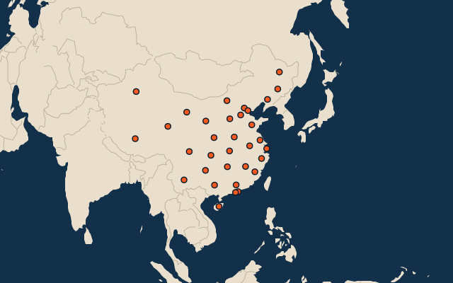
33 provinces, each one drawn on a satellite globe. Name it when it lights up, find it when you are given its name, or type every one you can remember in Name all.
All 33 provincial-level divisions the PRC administers, largest first. Free to start: a few quizzes a day cost nothing, and Geotcha Plus opens every quiz. What you miss comes back for review until it sticks.
The full list
About this quiz
Xinjiang is the largest of the 33 provinces in this quiz, at 1,664,897 km²; Macau is the smallest listed, at 33 km². The three largest hold 43% of the combined area of all 33.
What they are known for
- Xinjiang: Vast far-west region and homeland of the Uyghurs, bordering eight countries.
- Tibet: Averages over 4,000 m and holds Everest’s north face; Lhasa and the Potala Palace are here.
- Inner Mongolia: Crescent-shaped northern region of grassland and Gobi dunes, bordering eight other provincial divisions; capital Hohhot.
- Qinghai: The Yangtze, Yellow and Mekong rivers all rise here; capital Xining.
- Sichuan: Home of the giant panda and numbing-spicy peppercorns; Chengdu is its capital.
- Heilongjiang: Northernmost province, with Harbin’s ice festival and Siberian winters.
- Gansu: The Silk Road’s Hexi Corridor, the Mogao Caves at Dunhuang and the Wall’s western fort are here.
- Yunnan: Most ethnically diverse province, with Kunming the City of Eternal Spring and Tiger Leaping Gorge.
The provinces
- 1Xinjiang1,664,897 km²
- 2Tibet1,228,400 km²
- 3Inner Mongolia1,181,104 km²
- 4Qinghai696,700 km²
- 5Sichuan485,000 km²
- 6Heilongjiang454,800 km²
- 7Gansu425,800 km²
- 8Yunnan394,100 km²
- 9Guangxi235,001 km²
- 10Hunan211,836 km²
- 11Shaanxi205,800 km²
- 12Jilin187,400 km²
- 13Hebei187,240 km²
- 14Hubei185,900 km²
- 15Guangdong179,800 km²
- 16Guizhou176,167 km²
- 17Henan167,000 km²
- 18Jiangxi166,900 km²
- 19Shandong156,700 km²
- 20Shanxi156,000 km²
- 21Liaoning145,900 km²
- 22Anhui139,000 km²
- 23Fujian121,400 km²
- 24Zhejiang101,800 km²
- 25Jiangsu98,285 km²
- 26Chongqing82,403 km²
- 27Ningxia66,400 km²
- 28Hainan33,920 km²
- 29Beijing16,411 km²
- 30Tianjin11,920 km²
- 31Shanghai6,341 km²
- 32Hong Kong1,114 km²
- 33Macau33 km²
On the map
More sets
- Countries of the world
- World capitals
- Bodies of water
- Straits & channels
- Continents and oceans
- Longest river systems
- Largest lakes
- Largest islands
- Famous peaks
- Famous volcanoes
- Mountain ranges
- Largest deserts
- US states
- Counties of England
- The 32 counties of Ireland
- Regions bigger than countries
- Largest cities of the world
- Largest cities of China
- Largest cities of Egypt
- Europe’s 5 shortest land borders
- The 10 closest pairs of capitals
How the figures are measured
The provincial-level divisions administered by the People's Republic of China: 22 provinces, 5 autonomous regions, 4 municipalities and the 2 special administrative regions (Hong Kong, Macau). Taiwan, which the PRC claims as a province but does not administer, is excluded. Area in km²: Wikidata figures checked against official Chinese reference totals (provincial land area; Gansu and Ningxia pinned to the official figures). Hong Kong and Macau use their governments' land-area figures.