GeotchaA geography quiz on a real globe
Europe’s 5 shortest land borders
5 borders, each one drawn on a satellite globe. Name it when it lights up, find it when you are given its name, or type every one you can remember in Name all.
Name the two countries on each border. Free to play, with no account needed. What you miss comes back for review until it sticks.
Show the answers
About this quiz
The list runs from Vatican City – Italy (3.2 km) to Liechtenstein – Switzerland (41 km).
What they are known for
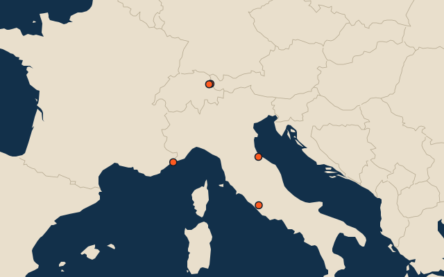
- Vatican City – Italy: The boundary around the walled enclave in Rome.
- Monaco – France: A Mediterranean principality with just one land neighbour, near Nice.
- Liechtenstein – Austria: The mountainous eastern and northern side of a doubly landlocked Alpine principality.
- San Marino – Italy: The perimeter of the mountain republic near Rimini.
- Liechtenstein – Switzerland: The western and southern boundary of a small Alpine principality, much of it along the Rhine.
The borders
- 1Vatican City – Italy Vatican City3.2 km
- 2Monaco – France Monaco5.5 km
- 3Liechtenstein – Austria Liechtenstein37 km
- 4San Marino – Italy San Marino39 km
- 5Liechtenstein – Switzerland Liechtenstein41 km
On the map
More sets
- Countries of the world
- World capitals
- Bodies of water
- Straits & channels
- Continents and oceans
- Longest river systems
- Largest lakes
- Largest islands
- Famous peaks
- Famous volcanoes
- Mountain ranges
- Largest deserts
- US states
- Provinces of China
- Counties of England
- The 32 counties of Ireland
- Largest cities of the world
- Largest cities of China
- Largest cities of Egypt
How the figures are measured
The five shortest complete land boundaries between pairs of sovereign states, located in Europe, ranked by published length. River sections count; maritime boundaries do not. Name both countries, in either order. A country may appear in more than one answer. Dependent territories such as Gibraltar, overseas borders such as Saint Martin, and individual enclave segments are excluded. Published survey methods and rounding differ; figures are not newly measured from this map.