GeotchaA geography quiz on a real globe
States of Germany
16 states, each one drawn on a satellite globe. Name it when it lights up, find it when you are given its name, tell its flag from three others, or type every one you can remember in Name all.
Free to play, with no account needed. What you miss comes back for review until it sticks.
The states
- 1Bavaria70,551 km²
- 2Lower Saxony47,614 km²
- 3Baden-Württemberg35,752 km²
- 4North Rhine-Westphalia34,113 km²
- 5Brandenburg29,479 km²
- 6Mecklenburg-Western Pomerania23,174 km²
- 7Hesse21,100 km²
- 8Saxony-Anhalt20,454 km²
- 9Rhineland-Palatinate19,853 km²
- 10Saxony18,416 km²
- 11Thuringia16,171 km²
- 12Schleswig-Holstein15,763 km²
- 13Saarland2,570 km²
- 14Berlin891 km²
- 15Hamburg755 km²
- 16Bremen419 km²
Area in km²: Wikidata’s figure (P2046, the whole or the land area, whichever matches the outline) where it is within a factor of two of the outline’s area. Each item names its source. Sources: OpenStreetMap (ODbL), Wikidata (CC0).
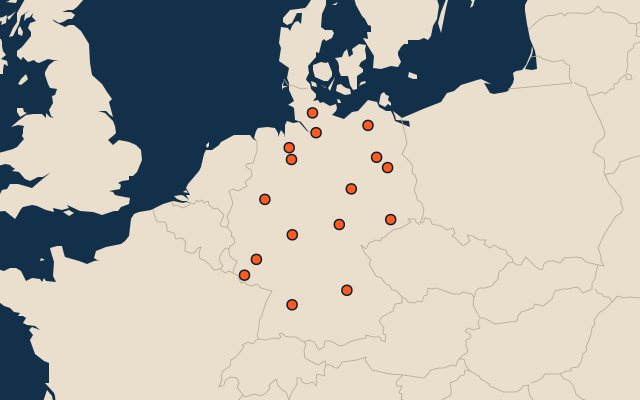
On the map
More in Germany
- 25 largest cities in Germany
- 10 most populous states of Germany
- 12 largest lakes in Germany
- 25 longest rivers in Germany
- 25 highest peaks in Germany
- 25 largest islands in Germany
- Flags of German states
- 10 largest cities in Germany
- Cities ranked 26–50 in Germany
- State capitals of Germany
Similar quizzes
- States and the federal district of the United States
- 10 most populous states and the federal district of the United States
- Provinces and territories of Canada
- 10 most populous provinces and territories of Canada
- States and the capital city of Mexico
- 10 most populous states and the capital city of Mexico
- States and the federal district of Brazil
- 10 most populous states and the federal district of Brazil
- Provinces and the autonomous city of Argentina
- 10 most populous provinces and the autonomous city of Argentina
- US states