GeotchaA geography quiz on a real globe
10 most populous states of Germany
10 states, each one drawn on a satellite globe. Name it when it lights up, find it when you are given its name, tell its flag from three others, or type every one you can remember in Name all.
Free to start: a few quizzes a day cost nothing, and Geotcha Plus opens every quiz. What you miss comes back for review until it sticks.
The full list
About this quiz
North Rhine-Westphalia is the largest of the 10 states in this quiz, at 18 M; Brandenburg is the smallest listed, at 2.5 M. The three largest hold 57% of the combined population of all 10.
What they are known for
- North Rhine-Westphalia: Most populous state: the Ruhr's old coal and steel belt, Cologne Cathedral, Düsseldorf and carnival.
- Bavaria: Oktoberfest in Munich, Neuschwanstein castle, beer halls, the Alps and Zugspitze, and BMW.
- Baden-Württemberg: Black Forest, cuckoo clocks and Lake Constance; home of Mercedes-Benz, Porsche and Heidelberg's castle.
- Lower Saxony: Flat northern state with Volkswagen in Wolfsburg, the Harz mountains, East Frisian islands and Hanover fair.
- Hesse: Frankfurt's skyline, stock exchange and airport hub; also the Rheingau vineyards and apple wine.
- Rhineland-Palatinate: Rhine and Moselle wine slopes with castles, the Loreley rock and Gutenberg's Mainz.
- Saxony: Dresden's Frauenkirche and Semperoper, Leipzig's trade fairs and Bach, plus Elbe sandstone cliffs.
- Schleswig-Holstein: Between the North and Baltic Seas: Kiel regatta, Wadden Sea mudflats, Sylt island and a Danish minority.
The states
- 1North Rhine-Westphalia18 M
- 2Bavaria13.1 M
- 3Baden-Württemberg11.2 M
- 4Lower Saxony8 M
- 5Hesse6.2 M
- 6Rhineland-Palatinate4.1 M
- 7Saxony4.1 M
- 8Berlin3.9 M
- 9Schleswig-Holstein3 M
- 10Brandenburg2.5 M
On the map
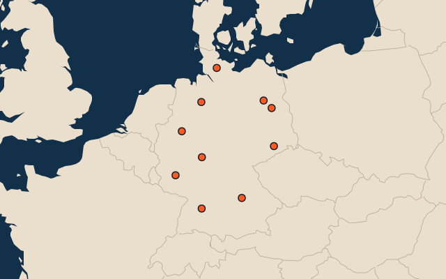
All of Europe
More in Germany
- 25 largest cities in Germany
- States of Germany
- 18 largest lakes in Germany
- 25 longest rivers in Germany
- 25 highest peaks in Germany
- 25 largest islands in Germany
- 25 best known World Heritage Sites in Germany
- Flags of the states of Germany
- 10 largest cities in Germany
- Districts of Germany
In the regions of Germany
- Districts of Baden-Württemberg
- Districts of Bavaria
- Districts of Hesse
- Districts of Lower Saxony
- Districts of North Rhine-Westphalia
- Districts of Rheinland-Pfalz
- Districts of Saarland
- Districts of Schleswig-Holstein
Other countries of Europe
- 25 most populous districts of Germany
- Regions of Italy
- 10 most populous regions of Italy
- Provinces of Italy
- 25 most populous provinces of Italy
- Regions of Russia
- 10 most populous regions of Russia
- Regions of France
How the figures are measured
First-level units: the 16 states; the 400 districts are the second level. Population of each region: a 2025 estimate: the latest official figure (a census or an estimate, as each item names it) scaled with the rest of its country’s regions to the World Bank’s 2025 national total, so a country’s regions share one year. Each item names its source and year. Regions without a figure are left out.