GeotchaA geography quiz on a real globe
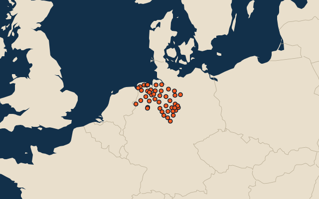
Districts of Lower Saxony
45 districts, each one drawn on a satellite globe. Name it when it lights up, find it when you are given its name, or type every one you can remember in Name all.
Free to play, with no account needed. What you miss comes back for review until it sticks.
The districts
- 1Emsland2,884 km²
- 2Region Hannover2,297 km²
- 3Osnabrück District2,122 km²
- 4Rotenburg2,075 km²
- 5Cuxhaven2,059 km²
- 6Diepholz1,991 km²
- 7Heidekreis1,881 km²
- 8Göttingen1,755 km²
- 9Gifhorn1,568 km²
- 10Celle1,551 km²
- 11Uelzen1,463 km²
- 12Cloppenburg1,420 km²
- 13Nienburg1,401 km²
- 14Lüneburg1,328 km²
- 15Aurich1,287 km²
- 16Northeim1,269 km²
- 17Stade1,267 km²
- 18Harburg1,248 km²
- 19Lüchow-Dannenberg1,227 km²
- 20Hildesheim1,208 km²
- 21Leer1,086 km²
- 22Oldenburg District1,065 km²
- 23Bentheim982 km²
- 24Goslar967 km²
- 25Wesermarsch825 km²
- 26Vechta814 km²
- 27Hamelin-Pyrmont798 km²
- 28Verden789 km²
- 29Ammerland731 km²
- 30Wolfenbüttel724 km²
- 31Holzminden694 km²
- 32Helmstedt676 km²
- 33Schaumburg676 km²
- 34Wittmund657 km²
- 35Osterholz653 km²
- 36Friesland610 km²
- 37Peine537 km²
- 38Salzgitter224 km²
- 39Wolfsburg205 km²
- 40Braunschweig193 km²
- 41Osnabrück120 km²
- 42Emden112 km²
- 43Wilhelmshaven107 km²
- 44Oldenburg103 km²
- 45Delmenhorst62 km²
Second-level units: the 400 districts, within the 16 states (the first level), which the region hint names. Area in km²: the official area where the national statistics office gives one (countries whose divisions changed since Natural Earth). Each item names its source. Sources: OpenStreetMap (ODbL), national statistics offices.
On the map