GeotchaA geography quiz on a real globe
Departments of Buenos Aires
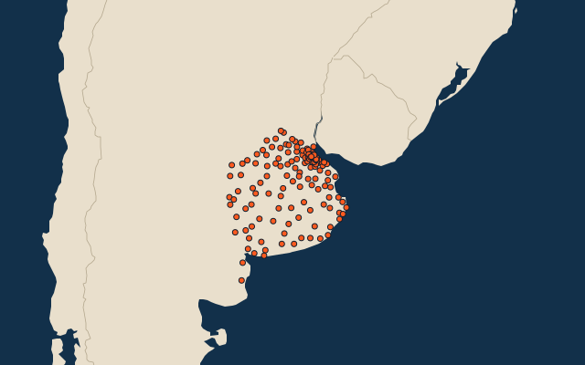
135 departments, each one drawn on a satellite globe. Name it when it lights up, find it when you are given its name, or type every one you can remember in Name all.
Free to play, with no account needed. What you miss comes back for review until it sticks.
The departments
- 1Patagones13,600 km²
- 2Villarino11,400 km²
- 3Olavarría7,715 km²
- 4General Villegas7,265 km²
- 5Ayacucho6,785 km²
- 6Azul6,615 km²
- 7Puan6,385 km²
- 8Coronel Suárez5,985 km²
- 9Adolfo Alsina5,875 km²
- 10Tres Arroyos5,861 km²
- 11Coronel Dorrego5,818 km²
- 12Lincoln5,772 km²
- 13Trenque Lauquen5,500 km²
- 14Benito Juárez5,285 km²
- 15Coronel Pringles5,245 km²
- 16Bolívar5,027 km²
- 17Tandil4,935 km²
- 18Guaminí4,840 km²
- 19General La Madrid4,800 km²
- 20Veinticinco de Mayo4,795 km²
- 21Lobería4,755 km²
- 22Pehuajó4,560 km²
- 23Necochea4,455 km²
- 24Rauch4,300 km²
- 25Nueve de Julio4,230 km²
- 26Tornquist4,183 km²
- 27Tapalqué4,172 km²
- 28Balcarce4,120 km²
- 29Rivadavia3,940 km²
- 30Carlos Tejedor3,933 km²
- 31Daireaux3,820 km²
- 32Adolfo Gonzáles Chaves3,780 km²
- 33Saavedra3,500 km²
- 34Pila3,493 km²
- 35Laprida3,440 km²
- 36General Alvear3,432 km²
- 37Las Flores3,350 km²
- 38Chascomús3,123 km²
- 39Mar Chiquita3,116 km²
- 40San Cayetano3,004 km²
- 41General Madariaga2,964 km²
- 42Pergamino2,950 km²
- 43Saladillo2,736 km²
- 44General Lavalle2,649 km²
- 45Maipú2,640 km²
- 46General Pinto2,545 km²
- 47Carlos Casares2,446 km²
- 48General Guido2,340 km²
- 49Bahía Blanca2,300 km²
- 50Chacabuco2,290 km²
- 51Junín2,260 km²
- 52Bragado2,230 km²
- 53General Viamonte2,150 km²
- 54Castelli2,100 km²
- 55Chivilcoy2,075 km²
- 56Rojas2,050 km²
- 57Dolores1,980 km²
- 58Monte1,890 km²
- 59General Belgrano1,870 km²
- 60Magdalena1,863 km²
and 75 more, all in the quiz.
Second-level units: the 513 departments, within the 24 provinces (the first level), which the region hint names. Area in km²: the official area where the national statistics office gives one (countries whose divisions changed since Natural Earth). Each item names its source. Sources: OpenStreetMap (ODbL), national statistics offices.
On the map