GeotchaA geography quiz on a real globe
10 coldest states of the United States
10 states, each one drawn on a satellite globe. Name it when it lights up, find it when you are given its name, tell its flag from three others, or type every one you can remember in Name all.
Free to start: a few quizzes a day cost nothing, and Geotcha Plus opens every quiz. What you miss comes back for review until it sticks.
The full list
About this quiz
The quiz covers 10 states, from Alaska and North Dakota to Wisconsin.
What they are known for
- Alaska: Bought from Russia in 1867; Denali towers here, and the Aleutian chain trails toward Siberia.
- North Dakota: Theodore Roosevelt ranched in its badlands; Bakken oil boom, sunflowers, wheat and Fargo.
- Maine: Lobsters, lighthouses, Acadia National Park and Stephen King's horror stories.
- Minnesota: Ten thousand lakes, the headwaters of the great river, and the Mall of America.
- Wyoming: Yellowstone, the first national park, is mostly here, with Old Faithful and the Tetons; fewest residents of any state.
- Montana: Glacier National Park lies on its northern border and Yellowstone spills into its south, under a huge open sky.
- Idaho: Famous for potatoes; the Snake River cuts across it and Sun Valley is a ski resort.
- Vermont: Maple syrup, Ben and Jerry's ice cream and the ski slopes of Stowe; Lake Champlain runs along much of its western edge.
The states
- 1Alaska−2.7 °C
- 2North Dakota5.2 °C
- 3Maine5.4 °C
- 4Minnesota5.5 °C
- 5Wyoming5.6 °C
- 6Montana6.1 °C
- 7Idaho6.3 °C
- 8Vermont6.3 °C
- 9New Hampshire6.8 °C
- 10Wisconsin6.9 °C
On the map
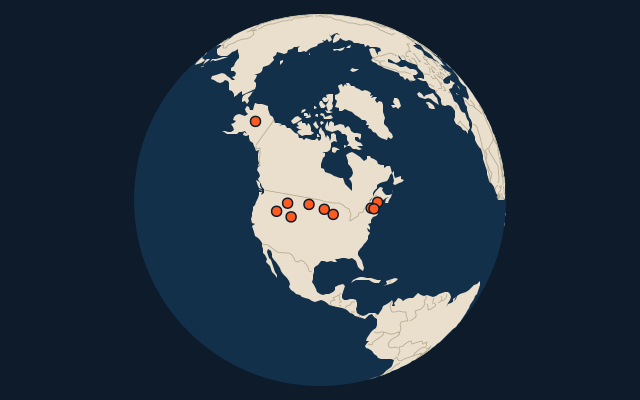
All of North America
More in United States
- 25 largest cities in the United States
- States of the United States
- 25 largest natural lakes in the United States
- 25 longest rivers in the United States
- 25 highest peaks in the United States
- 25 largest islands in the United States
- 8 largest glaciers in the United States by area
- Flags of US states
- 10 largest cities in the United States
- 10 most populous states of the United States
In the regions of United States
- Counties of Alaska
- Counties of Alabama
- Counties of Arkansas
- Counties of Arizona
- Counties of California
- Counties of Colorado
- Counties of Connecticut
- Counties of Florida, United States
Other countries of North America
- 10 hottest states of the United States
- 10 wettest states of the United States
- 10 driest states of the United States
- Counties of the United States
- 25 most populous counties of the United States
- States and the capital city of Mexico
- 10 most populous states and the capital city of Mexico
- Provinces and territories of Canada
All the US states
How the figures are measured
First-level units: the 51 states; the 3135 counties are the second level. Area in km²: Wikidata’s figure (P2046, the whole or the land area, whichever matches the outline) where it is within a factor of two of the outline’s area. Each item names its source.