GeotchaA geography quiz on a real globe
Counties of Alaska
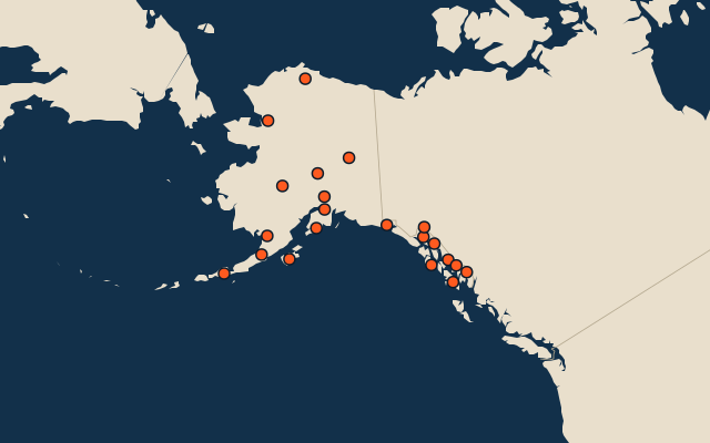
21 counties, each one drawn on a satellite globe. Name it when it lights up, find it when you are given its name, or type every one you can remember in Name all.
Free to play, with no account needed. What you miss comes back for review until it sticks.
The counties
- 1Unorganized Borough814,770 km²
- 2North Slope Borough230,052 km²
- 3Northwest Arctic Borough92,367 km²
- 4Matanuska-Susitna Borough63,991 km²
- 5Lake and Peninsula Borough61,724 km²
- 6Kenai Peninsula Borough41,485 km²
- 7Denali Borough32,740 km²
- 8Yakutat19,744 km²
- 9Fairbanks North Star Borough18,997 km²
- 10Aleutians East Borough18,092 km²
- 11Kodiak Island Borough17,324 km²
- 12Prince of Wales-Hyder Census Area13,643 km²
- 13Ketchikan Gateway Borough12,579 km²
- 14Petersburg Census Area7,513 km²
- 15Sitka7,433 km²
- 16Juneau7,003 km²
- 17Wrangell6,620 km²
- 18Haines Borough6,069 km²
- 19Anchorage4,421 km²
- 20Bristol Bay Borough1,248 km²
- 21Skagway1,124 km²
Second-level units: the 3135 counties, within the 51 states (the first level), which the region hint names. Area in km²: the official area where the national statistics office gives one (countries whose divisions changed since Natural Earth). Each item names its source. Sources: OpenStreetMap (ODbL), national statistics offices.
On the map
More in Alaska
- 17 largest natural lakes in Alaska
- 25 longest rivers in Alaska
- 25 highest peaks in Alaska
- 25 largest islands in Alaska