GeotchaA geography quiz on a real globe
25 longest rivers in the United States
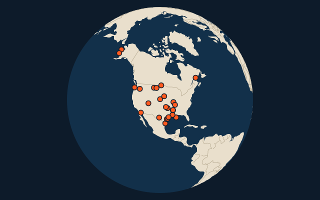
25 rivers, each one drawn on a satellite globe. Name it when it lights up, find it when you are given its name, or type every one you can remember in Name all.
Free to play, with no account needed. What you miss comes back for review until it sticks.
The rivers
- 1Mississippi3,766 km
- 2Missouri3,726 km
- 3Yukon3,190 km
- 4Rio Grande3,051 km
- 5Arkansas2,364 km
- 6Colorado2,334 km
- 7Red River (United States)2,189 km
- 8Columbia2,000 km
- 9Snake River1,735 km
- 10Ohio1,579 km
- 11Pecos1,560 km
- 12Canadian1,458 km
- 13Colorado (Texas)1,387 km
- 14Brazos1,352 km
- 15Souris1,240 km
- 16St. Lawrence1,197 km
- 17Green River1,175 km
- 18Milk River1,173 km
- 19White River1,162 km
- 20North Platte River1,152 km
- 21James (Dakotas)1,143 km
- 22Trinity1,140 km
- 23Kuskokwim1,130 km
- 24Cimarron1,123 km
- 25Yellowstone1,114 km
Length in km as Wikidata records it (P2043, the best-ranked figure). Each named river counts on its own: the river that carries the name, from its source to its mouth. Headstreams and tributaries with names of their own are rivers of their own, so the Missouri and the Mississippi are two rivers here, as are the Irtysh and the Ob (the Longest River Systems set measures such chains as one system, from the most distant source). A named section of a river is that river: the Solimões, as the Amazon’s upper course is called in Brazil, is the Amazon. Where the recorded length runs from a differently named headwater (the Congo’s from the Lualaba’s source), the course is drawn on up that headwater. Rivers under 200 km are in only when they are well known (30 or more Wikipedia editions), and a river whose mapped course covers under half its recorded length is left out.
On the map
More in United States
- 25 largest cities in the United States
- States and the federal district of the United States
- 25 largest lakes in the United States
- 25 highest peaks in the United States
- 25 largest islands in the United States
- 7 largest glaciers in the United States by area
- Flags of US states
- 10 largest cities in the United States
- 10 most populous states and the federal district of the United States
- Cities ranked 26–50 in the United States