GeotchaA geography quiz on a real globe
8 largest glaciers in the United States by area
8 glaciers, each one drawn on a satellite globe. Name it when it lights up, find it when you are given its name, or type every one you can remember in Name all.
Free to start: a few quizzes a day cost nothing, and Geotcha Plus opens every quiz. What you miss comes back for review until it sticks.
The full list
About this quiz
Stikine Icecap is the largest of the 8 glaciers in this quiz, at 21,869 km²; Boulder Glacier is the smallest listed, at 2.9 km². Stikine Icecap's area is 5.6 times Malaspina Glacier's (3,900 km²). The three largest hold 95% of the combined area of all 8.
What they are known for
- Malaspina Glacier: A glacier, 45 km long
- Hubbard Glacier: A glacier, 122 km long
The glaciers
- 1Stikine Icecap21,869 km²
- 2Malaspina Glacier3,900 km²
- 3Hubbard Glacier2,487 km²
- 4Bering Glacier1,070 km²
- 5Matanuska Glacier195 km²
- 6Margerie Glacier159 km²
- 7Mendenhall Glacier48 km²
- 8Boulder Glacier2.9 km²
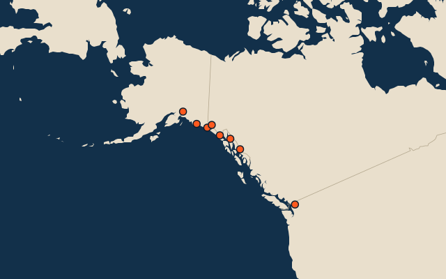
On the map
All of North America
- 14 largest glaciers in North America by area
- 14 best known canyons and gorges in North America
- 25 best known World Heritage Sites in North America
More in United States
- 25 largest cities in the United States
- States of the United States
- 25 largest natural lakes in the United States
- 25 longest rivers in the United States
- 25 highest peaks in the United States
- 25 largest islands in the United States
- 10 best known canyons and gorges in the United States
- Flags of US states
- 10 largest cities in the United States
- 10 most populous states of the United States
Other countries of North America
- 25 best known World Heritage Sites in the United States
- 8 best known plains in the United States
- 10 best known valleys in the United States
- 10 best known waterfalls in the United States
- 25 best known wine regions in the United States
- Wine regions of the United States
- 25 best known World Heritage Sites in Mexico
- 25 longest fjords in Canada
How the figures are measured
Area in km²: Wikidata’s (P2046), else measured on the OpenStreetMap outline where it fits; the Antarctic ice sheet’s from NSIDC. A glacier of unknown area is left out. Glaciers, ice caps, ice fields, ice sheets and ice shelves from Wikidata with articles in 10 or more Wikipedia editions, or 300 km² or larger, or 40 km or longer; a glacier that is also a mountain or volcano stays with the peaks.