GeotchaA geography quiz on a real globe
25 largest lakes and reservoirs in the United States
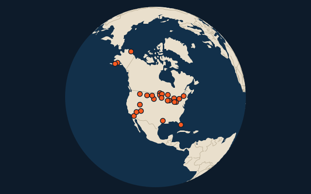
25 lakes and reservoirs, each one drawn on a satellite globe. Name it when it lights up, find it when you are given its name, or type every one you can remember in Name all.
Free to play, with no account needed. What you miss comes back for review until it sticks.
The lakes and reservoirs
- 1Lake Superior82,350 km²
- 2Lake Huron59,600 km²
- 3Lake Michigan57,750 km²
- 4Lake Erie25,744 km²
- 5Lake Ontario18,529 km²
- 6Great Salt Lake4,400 km²
- 7Lake of the Woods4,350 km²
- 8Iliamna Lake2,622 km²
- 9Lake Oahe1,922 km²
- 10Lake Okeechobee1,890 km²
- 11Lake Sakakawea1,626 km²
- 12Lake Champlain1,269 km²
- 13Becharof Lake1,170 km²
- 14Red Lake1,148 km²
- 15Lake St. Clair1,114 km²
- 16Fort Peck Lake1,040 km²
- 17Rainy Lake932 km²
- 18Salton Sea888 km²
- 19Teshekpuk Lake864 km²
- 20Toledo Bend Reservoir811 km²
- 21Lake Powell658 km²
- 22Lake Mead640 km²
- 23Lake Winnebago557 km²
- 24Mille Lacs Lake536 km²
- 25Flathead Lake510 km²
Surface area in km²: the Largest Lakes set’s figure for its lakes, else Wikidata’s (P2046) where it fits the outline, else the area of the outline. Seasonal salt pans keep their recorded figure; their area varies. Every named lake Natural Earth maps at 1:10m (with its supplements for Europe, North America and Australia), and every lake of the Largest Lakes set. The Caspian Sea counts as a lake, as in that set; coastal lagoons (the Vistula Lagoon, the Black Sea limans) do not. Countries are those on its shores, from the outlines. Reservoirs (artificial lakes behind a dam, as Natural Earth or Wikidata mark them) count along with the natural lakes.
On the map
More in United States
- 25 largest cities in the United States
- States and the federal district of the United States
- 25 largest lakes in the United States
- 25 longest rivers in the United States
- 25 highest peaks in the United States
- 25 largest islands in the United States
- 7 largest glaciers in the United States by area
- Flags of US states
- 10 largest cities in the United States
- 10 most populous states and the federal district of the United States
Similar quizzes
- 9 largest lakes and reservoirs in India
- 18 largest lakes and reservoirs in Brazil
- 25 largest lakes in China
- 12 largest lakes in Germany
- 7 largest lakes in Italy
- 25 largest lakes in Russia
- 8 largest lakes in France
- 11 largest lakes in the United Kingdom
- 25 largest lakes in Mexico
- 21 largest lakes in Turkey
- Largest lakes