GeotchaA geography quiz on a real globe
States of the German Empire in 1900
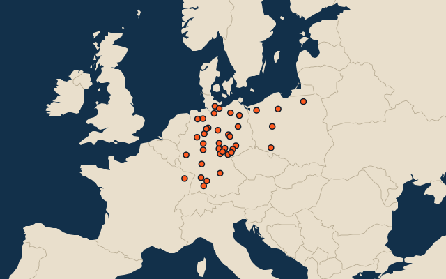
38 states of the German Empire, each one drawn on a satellite globe. Name it when it lights up, find it when you are given its name, or type every one you can remember in Name all.
Free to play, with no account needed. What you miss comes back for review until it sticks.
The states of the German Empire
- 1Kingdom of Bavaria76,214 km²
- 2Province of East Prussia53,688 km²
- 3Province of Silesia47,812 km²
- 4Province of Pomerania39,049 km²
- 5Hanover38,527 km²
- 6Kingdom of Saxony38,105 km²
- 7Province of Posen29,110 km²
- 8Province of Brandenburg27,162 km²
- 9Rhine Province26,947 km²
- 10Province of West Prussia26,198 km²
- 11Province of Saxony25,593 km²
- 12Province of Westphalia20,232 km²
- 13Württemberg19,543 km²
- 14Province of Schleswig-Holstein18,489 km²
- 15Province of Hesse-Nassau16,775 km²
- 16Baden15,234 km²
- 17Alsace-Lorraine14,519 km²
- 18Grand Duchy of Mecklenburg-Schwerin13,060 km²
- 19Hesse10,923 km²
- 20Oldenburg6,492 km²
- 21Brunswick3,723 km²
- 22Saxe-Weimar-Eisenach3,598 km²
- 23Grand Duchy of Mecklenburg-Strelitz2,612 km²
- 24Saxe-Coburg and Gotha2,479 km²
- 25Saxe-Meiningen2,457 km²
- 26Duchy of Anhalt2,327 km²
- 27Saxe-Altenburg1,308 km²
- 28Principality of Lippe1,215 km²
- 29Hohenzollern Lands1,134 km²
- 30Waldeck-Pyrmont1,118 km²
- 31Principality of Schwarzburg-Rudolstadt928 km²
- 32Principality of Schwarzburg-Sondershausen850 km²
- 33Principality of the Reuss Junior Line835 km²
- 34Free and Hanseatic City of Hamburg399 km²
- 35Free and Hanseatic City of Lübeck384 km²
- 36Schaumburg-Lippe346 km²
- 37Principality of Reuss-Greiz308 km²
- 38Bremen251 km²
The map as it stood on 1 July 1900 (a year means its 1 July), with the names of the time. The parts of a state as it was then: its first-level regions as OpenHistoricalMap draws them. Area in km², measured on the largest of its outlines (simplified, clipped to land). Sources: OpenHistoricalMap contributors (CC0), Wikidata (CC0).
On the map
Similar quizzes
- Regions formerly held by Russia
- Regions formerly held by the Ottoman Empire
- Regions formerly held by Austria
- Regions formerly held by Hungary
- Regions formerly held by Germany
- Regions formerly held by Poland
- Regions formerly held by the Holy Roman Empire
- Regions formerly held by Denmark
- Soviet republics in 1980
- US states and territories in 1850
- US states