GeotchaA geography quiz on a real globe
Soviet republics in 1980
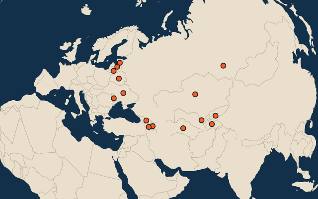
15 Soviet republics, each one drawn on a satellite globe. Name it when it lights up, find it when you are given its name, or type every one you can remember in Name all.
Free to play, with no account needed. What you miss comes back for review until it sticks.
The Soviet republics
- 1Russian Soviet Federative Socialist Republic21,975,180 km²
- 2Kazakh SSR2,704,480 km²
- 3Turkmen SSR472,025 km²
- 4Ukrainian SSR451,431 km²
- 5Uzbek SSR446,967 km²
- 6Byelorussian SSR224,650 km²
- 7Kirghiz SSR198,122 km²
- 8Tajik SSR141,118 km²
- 9Azerbaijan SSR86,493 km²
- 10Georgian SSR69,633 km²
- 11Latvian Soviet Socialist Republic65,891 km²
- 12Lithuanian SSR62,147 km²
- 13Estonia SSR47,327 km²
- 14Moldavian SSR33,776 km²
- 15Armenian SSR29,691 km²
The map as it stood on 1 July 1980 (a year means its 1 July), with the names of the time. The parts of a state as it was then: its first-level regions as OpenHistoricalMap draws them. Area in km², measured on the largest of its outlines (simplified, clipped to land). Sources: OpenHistoricalMap contributors (CC0), Wikidata (CC0).
On the map
More in Soviet Union
Similar quizzes
- Regions formerly held by Russia
- Regions formerly held by the Ottoman Empire
- Regions formerly held by Austria
- Regions formerly held by Hungary
- Regions formerly held by Germany
- Regions formerly held by Poland
- Regions formerly held by the Holy Roman Empire
- Regions formerly held by Denmark
- States of the German Empire in 1900
- US states and territories in 1850
- US states