GeotchaA geography quiz on a real globe
Provinces of Argentina
24 provinces, each one drawn on a satellite globe. Name it when it lights up, find it when you are given its name, tell its flag from three others, or type every one you can remember in Name all.
Free to play, with no account needed. What you miss comes back for review until it sticks.
The provinces
- 1Buenos Aires Province307,571 km²
- 2Santa Cruz243,943 km²
- 3Chubut224,686 km²
- 4Río Negro203,013 km²
- 5Córdoba165,321 km²
- 6Salta155,488 km²
- 7Mendoza148,827 km²
- 8La Pampa143,440 km²
- 9Santiago del Estero136,351 km²
- 10Santa Fe133,007 km²
- 11Catamarca102,602 km²
- 12Chaco99,633 km²
- 13Neuquén94,078 km²
- 14La Rioja89,680 km²
- 15San Juan89,651 km²
- 16Corrientes88,199 km²
- 17Entre Ríos78,781 km²
- 18San Luis76,748 km²
- 19Formosa72,066 km²
- 20Jujuy53,219 km²
- 21Misiones29,801 km²
- 22Tucumán22,524 km²
- 23Tierra del Fuego21,571 km²
- 24Buenos Aires City203 km²
First-level units: the 24 provinces; the 513 departments are the second level. Area in km²: Wikidata’s figure (P2046, the whole or the land area, whichever matches the outline) where it is within a factor of two of the outline’s area. Each item names its source. Sources: OpenStreetMap (ODbL), Wikidata (CC0).
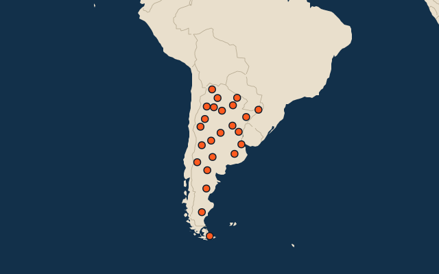
On the map
More in Argentina
- 25 largest cities in Argentina
- 10 most populous provinces of Argentina
- 12 largest lakes in Argentina
- 25 longest rivers in Argentina
- 25 highest peaks in Argentina
- 10 largest islands in Argentina
- Flags of the provinces of Argentina
- 10 largest cities in Argentina
- Departments of Argentina
- Cities ranked 26–50 in Argentina
Similar quizzes
- States of the United States
- 10 most populous states of the United States
- Counties of the United States
- 25 most populous counties of the United States
- States of India
- 10 most populous states of India
- Districts of India
- 25 most populous districts of India
- States and the federal district of Brazil
- 10 most populous states and the federal district of Brazil
- US states