GeotchaA geography quiz on a real globe
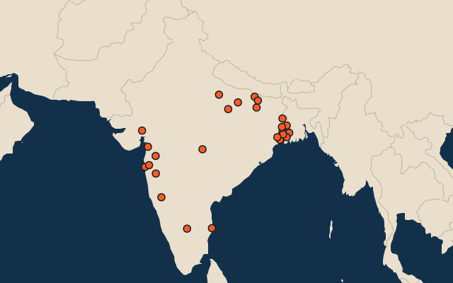
25 most populous districts of India
25 districts, each one drawn on a satellite globe. Name it when it lights up, find it when you are given its name, or type every one you can remember in Name all.
Free to play, with no account needed. What you miss comes back for review until it sticks.
The districts
- 1North 24 Parganas10 M
- 2Bangalore Urban9.6 M
- 3Pune9.4 M
- 4Mumbai Suburban9.4 M
- 5South 24 Parganas8.2 M
- 6Thane8.1 M
- 7Murshidabad7.1 M
- 8Ahmedabad7 M
- 9Chennai6.7 M
- 10Nashik6.1 M
- 11Surat6.1 M
- 12Allahabad6 M
- 13Patna5.8 M
- 14Hooghly5.5 M
- 15Nadia5.2 M
- 16East Champaran5.1 M
- 17Purba Medinipur5.1 M
- 18Howrah4.9 M
- 19Purba Bardhaman4.8 M
- 20Muzaffarpur4.8 M
- 21Belgaum4.8 M
- 22Paschim Medinipur4.8 M
- 23Nagpur4.7 M
- 24Azamgarh4.6 M
- 25Lucknow4.6 M
Second-level units: the 770 districts, within the 36 states (the first level), which the region hint names. Population of each region: for countries whose divisions changed since Natural Earth, the figure of the national statistics office, as each item names it. Each item names its source and year. Regions without a figure are left out. Sources: OpenStreetMap (ODbL), national statistics offices, as each item names.
On the map
More in India
- 25 largest cities in India
- States of India
- 9 largest lakes and reservoirs in India
- 25 longest rivers in India
- 25 highest peaks in India
- 25 largest islands in India
- 10 largest cities in India
- 10 most populous states of India
- Cities ranked 26–50 in India
- Districts of India
Similar quizzes
- States of the United States
- 10 most populous states of the United States
- Counties of the United States
- 25 most populous counties of the United States
- States and the federal district of Brazil
- 10 most populous states and the federal district of Brazil
- Provinces of China
- 10 most populous provinces of China
- Prefectures of China
- 25 most populous prefectures of China
- US states