GeotchaA geography quiz on a real globe
10 largest islands in Argentina
10 islands, each one drawn on a satellite globe. Name it when it lights up, find it when you are given its name, or type every one you can remember in Name all.
Free to start: a few quizzes a day cost nothing, and Geotcha Plus opens every quiz. What you miss comes back for review until it sticks.
The full list
About this quiz
Isla Grande de Tierra del Fuego is the largest of the 10 islands in this quiz, at 47,992 km²; Martín García Island is the smallest listed, at 2 km². Isla Grande de Tierra del Fuego's area is more than ten times Isla de los Estados's (501 km²). The three largest hold 99% of the combined area of all 10.
What they are known for
- Isla Grande de Tierra del Fuego: Island at the southern tip of South America, split between Chile and Argentina, with Ushuaia, often called the world's southernmost city.
The islands
- 1Isla Grande de Tierra del Fuego47,992 km²
- 2Isla de los Estados501 km²
- 3Weddell Island254 km²
- 4Isla Trinidad207 km²
- 5Îles Solís66 km²
- 6Isla Bermejo55 km²
- 7Gable Island22 km²
- 8Isla Tovita15 km²
- 9Isla Leones6 km²
- 10Martín García Island2 km²
On the map
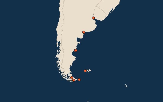
All of South America
More in Argentina
- 25 largest cities in Argentina
- Provinces of Argentina
- 14 largest lakes in Argentina
- 25 longest rivers in Argentina
- 25 highest peaks in Argentina
- 11 best known World Heritage Sites in Argentina
- Flags of the provinces of Argentina
- 10 largest cities in Argentina
- 10 most populous provinces of Argentina
- 16 best known wine regions in Argentina
Other countries of South America
- 25 largest islands in Brazil
- 11 largest islands in Colombia
- 21 largest islands in Venezuela
- 6 largest islands in Peru
- 25 largest islands in Chile
- 25 largest islands in Ecuador
The whole world
How the figures are measured
Land area in km²: the Largest Islands set’s figure for its islands, else Wikidata’s (P2046) where it fits the outline, else the area of the outline. Every island Natural Earth draws at 1:10m that Wikidata names, of 5 km² or more (smaller ones when well known), and every island of the Largest Islands set. Countries are those the island’s land lies in, from the outlines.