GeotchaA geography quiz on a real globe
Departments of Argentina
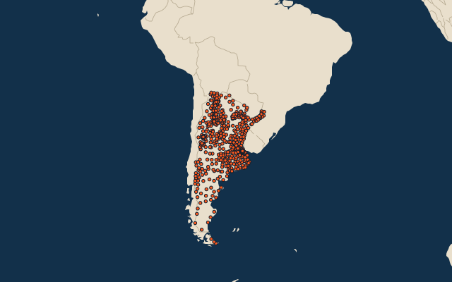
513 departments, each one drawn on a satellite globe. Name it when it lights up, find it when you are given its name, or type every one you can remember in Name all.
Free to play, with no account needed. What you miss comes back for review until it sticks.
The departments
- 1Deseado63,784 km²
- 2Malargüe41,317 km²
- 3Lago Argentino37,292 km²
- 4Río Chico34,262 km²
- 5Güer Aike33,841 km²
- 6San Rafael31,235 km²
- 7Lago Buenos Aires28,609 km²
- 8Antofagasta de la Sierra28,097 km²
- 9Veinticinco de Mayo27,106 km²
- 10Corpen Aike26,350 km²
- 11Rivadavia25,951 km²
- 12Los Andes25,636 km²
- 13Nueve de Julio25,597 km²
- 14General Güemes25,487 km²
- 15Patiño24,502 km²
- 16Tinogasta23,582 km²
- 17Calingasta22,589 km²
- 18El Cuy22,475 km²
- 19Río Senguer22,335 km²
- 20Paso de Indios22,300 km²
- 21Anta21,945 km²
- 22Vera21,096 km²
- 23Valcheta20,457 km²
- 24Avellaneda20,379 km²
- 25Telsen19,893 km²
- 26Magallanes19,805 km²
- 27Iglesia19,801 km²
- 28Gobernador Dupuy19,632 km²
- 29Río Cuarto18,394 km²
- 30Almirante Brown17,276 km²
- 31Nueve de Julio16,870 km²
- 32Gastre16,335 km²
- 33General José de San Martín16,257 km²
- 34Cushamen16,250 km²
- 35Moreno16,127 km²
- 36Florentino Ameghino16,088 km²
- 37Mártires15,445 km²
- 38Pichi Mahuida15,378 km²
- 39Languiñeo15,339 km²
- 40General Pedernera15,057 km²
- 41San Cristóbal14,850 km²
- 42Tehuelches14,750 km²
- 43Jáchal14,749 km²
- 44General Roca14,655 km²
- 45Sarmiento14,563 km²
- 46General Alvear14,448 km²
- 47Escalante14,015 km²
- 48San Antonio14,015 km²
- 49San Justo13,677 km²
- 50Capital13,638 km²
- 51Patagones13,600 km²
- 52Alberdi13,507 km²
- 53Puelén13,160 km²
- 54Curacó13,125 km²
- 55La Capital13,120 km²
- 56Utracán12,967 km²
- 57Belén12,945 km²
- 58Biedma12,940 km²
- 59Bermejo12,850 km²
- 60General Roca12,659 km²
and 453 more, all in the quiz.
Second-level units: the 513 departments, within the 24 provinces (the first level), which the region hint names. Area in km²: Wikidata’s figure (P2046, the whole or the land area, whichever matches the outline) where it is within a factor of two of the outline’s area; the official area where the national statistics office gives one (countries whose divisions changed since Natural Earth). Each item names its source. Sources: OpenStreetMap (ODbL), Wikidata (CC0), national statistics offices.
On the map
More in Argentina
- 25 largest cities in Argentina
- Provinces of Argentina
- 12 largest lakes in Argentina
- 25 longest rivers in Argentina
- 25 highest peaks in Argentina
- 10 largest islands in Argentina
- Flags of the provinces of Argentina
- 10 largest cities in Argentina
- 10 most populous provinces of Argentina
- Cities ranked 26–50 in Argentina
Similar quizzes
- States of the United States
- 10 most populous states of the United States
- Counties of the United States
- 25 most populous counties of the United States
- States of India
- 10 most populous states of India
- Districts of India
- 25 most populous districts of India
- States and the federal district of Brazil
- 10 most populous states and the federal district of Brazil
- US states