GeotchaA geography quiz on a real globe
Municipalities of Innlandet
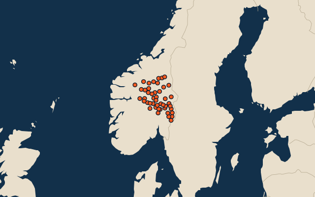
46 municipalities, each one drawn on a satellite globe. Name it when it lights up, find it when you are given its name, or type every one you can remember in Name all.
Free to play, with no account needed. What you miss comes back for review until it sticks.
The municipalities
- 1Rendalen3,061 km²
- 2Trysil2,941 km²
- 3Lesja2,167 km²
- 4Stor-Elvdal2,127 km²
- 5Skjåk1,965 km²
- 6Engerdal1,916 km²
- 7Lom1,887 km²
- 8Tynset1,822 km²
- 9Dovre1,349 km²
- 10Vang1,309 km²
- 11Åmot1,293 km²
- 12Folldal1,260 km²
- 13Vågå1,252 km²
- 14Ringebu1,221 km²
- 15Elverum1,209 km²
- 16Gausdal1,146 km²
- 17Ringsaker1,123 km²
- 18Tolga1,097 km²
- 19Nord-Fron1,092 km²
- 20Sør-Aurdal1,068 km²
- 21Os1,007 km²
- 22Åsnes1,004 km²
- 23Kongsvinger953 km²
- 24Nordre Land920 km²
- 25Alvdal919 km²
- 26Sel888 km²
- 27Øystre Slidre886 km²
- 28Nord-Aurdal849 km²
- 29Grue777 km²
- 30Sør-Fron712 km²
- 31Våler678 km²
- 32Søndre Land659 km²
- 33Gran657 km²
- 34Stange641 km²
- 35Gjøvik629 km²
- 36Øyer616 km²
- 37Eidskog603 km²
- 38Østre Toten485 km²
- 39Sør-Odal479 km²
- 40Nord-Odal475 km²
- 41Lillehammer451 km²
- 42Etnedal443 km²
- 43Vestre Slidre415 km²
- 44Løten362 km²
- 45Hamar338 km²
- 46Vestre Toten233 km²
Second-level units: the 355 municipalities, within the 15 counties (the first level), which the region hint names. Area in km²: the official area where the national statistics office gives one (countries whose divisions changed since Natural Earth). Each item names its source. Sources: OpenStreetMap (ODbL), national statistics offices.
On the map