GeotchaA geography quiz on a real globe
Counties of Wisconsin
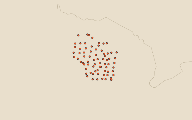
72 counties, each one drawn on a satellite globe. Name it when it lights up, find it when you are given its name, or type every one you can remember in Name all.
Free to play, with no account needed. What you miss comes back for review until it sticks.
The counties
- 1Marathon County4,002 km²
- 2Bayfield County3,828 km²
- 3Marinette County3,625 km²
- 4Douglas County3,378 km²
- 5Sawyer County3,257 km²
- 6Price County3,248 km²
- 7Clark County3,133 km²
- 8Dane County3,099 km²
- 9Grant County2,970 km²
- 10Oneida County2,885 km²
- 11Ashland County2,706 km²
- 12Forest County2,627 km²
- 13Chippewa County2,612 km²
- 14Oconto County2,583 km²
- 15Jackson County2,559 km²
- 16Taylor County2,525 km²
- 17Polk County2,368 km²
- 18Rusk County2,366 km²
- 19Monroe County2,333 km²
- 20Shawano County2,313 km²
- 21Lincoln County2,276 km²
- 22Dodge County2,268 km²
- 23Langlade County2,255 km²
- 24Barron County2,235 km²
- 25Vilas County2,221 km²
- 26Dunn County2,202 km²
- 27Sauk County2,154 km²
- 28Burnett County2,128 km²
- 29Portage County2,074 km²
- 30Washburn County2,065 km²
- 31Wood County2,054 km²
- 32Vernon County2,050 km²
- 33Juneau County1,987 km²
- 34Columbia County1,983 km²
- 35Iowa County1,975 km²
- 36Iron County1,964 km²
- 37Waupaca County1,937 km²
- 38Trempealeau County1,898 km²
- 39St. Croix County1,870 km²
- 40Fond du Lac County1,864 km²
- 41Rock County1,860 km²
- 42Buffalo County1,750 km²
- 43Adams County1,672 km²
- 44Eau Claire County1,652 km²
- 45Outagamie County1,651 km²
- 46Lafayette County1,641 km²
- 47Waushara County1,622 km²
- 48Manitowoc County1,526 km²
- 49Richland County1,518 km²
- 50Green County1,513 km²
- 51Pierce County1,487 km²
- 52Crawford County1,478 km²
- 53Jefferson County1,441 km²
- 54Walworth County1,438 km²
- 55Waukesha County1,424 km²
- 56Brown County1,373 km²
- 57Sheboygan County1,325 km²
- 58Florence County1,264 km²
- 59Door County1,248 km²
- 60Marquette County1,180 km²
and 12 more, all in the quiz.
Second-level units: the 3135 counties, within the 51 states (the first level), which the region hint names. Area in km²: the official area where the national statistics office gives one (countries whose divisions changed since Natural Earth). Each item names its source. Sources: OpenStreetMap (ODbL), national statistics offices.
On the map
More in Wisconsin
- 10 largest cities in Wisconsin
- 8 largest natural lakes in Wisconsin
- 17 longest rivers in Wisconsin
- 11 largest lakes and reservoirs in Wisconsin