GeotchaA geography quiz on a real globe
Counties of Texas
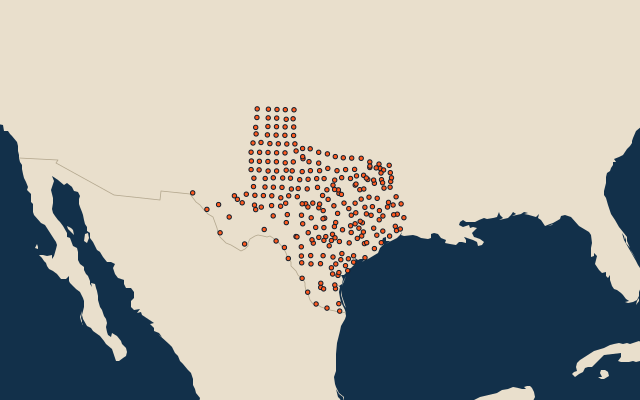
254 counties, each one drawn on a satellite globe. Name it when it lights up, find it when you are given its name, or type every one you can remember in Name all.
Free to play, with no account needed. What you miss comes back for review until it sticks.
The counties
- 1Brewster County16,016 km²
- 2Pecos County12,338 km²
- 3Hudspeth County11,838 km²
- 4Presidio County9,985 km²
- 5Culberson County9,873 km²
- 6Webb County8,706 km²
- 7Val Verde County8,145 km²
- 8Crockett County7,271 km²
- 9Reeves County6,826 km²
- 10Terrell County6,107 km²
- 11Jeff Davis County5,865 km²
- 12Edwards County5,485 km²
- 13Duval County4,645 km²
- 14Harris County4,421 km²
- 15Hidalgo County4,069 km²
- 16Uvalde County4,019 km²
- 17Tom Green County3,942 km²
- 18Dallam County3,893 km²
- 19Gaines County3,891 km²
- 20Andrews County3,887 km²
- 21Oldham County3,886 km²
- 22Deaf Smith County3,877 km²
- 23La Salle County3,851 km²
- 24Hartley County3,786 km²
- 25Kenedy County3,778 km²
- 26Sutton County3,766 km²
- 27Brazoria County3,531 km²
- 28Kinney County3,524 km²
- 29Dimmit County3,442 km²
- 30Medina County3,433 km²
- 31Schleicher County3,395 km²
- 32Zavala County3,360 km²
- 33Maverick County3,314 km²
- 34Coleman County3,271 km²
- 35Kimble County3,240 km²
- 36Upton County3,215 km²
- 37Bexar County3,212 km²
- 38Houston County3,188 km²
- 39Starr County3,168 km²
- 40Atascosa County3,159 km²
- 41Reagan County3,044 km²
- 42Liberty County3,000 km²
- 43McMullen County2,952 km²
- 44Jim Hogg County2,943 km²
- 45San Saba County2,940 km²
- 46Frio County2,936 km²
- 47Williamson County2,890 km²
- 48Kerr County2,858 km²
- 49Matagorda County2,831 km²
- 50Clay County2,820 km²
- 51Wharton County2,813 km²
- 52Erath County2,805 km²
- 53Leon County2,779 km²
- 54Gonzales County2,763 km²
- 55McCulloch County2,760 km²
- 56Anderson County2,752 km²
- 57Gillespie County2,741 km²
- 58Polk County2,738 km²
- 59Bell County2,729 km²
- 60Cherokee County2,727 km²
and 194 more, all in the quiz.
Second-level units: the 3135 counties, within the 51 states (the first level), which the region hint names. Area in km²: the official area where the national statistics office gives one (countries whose divisions changed since Natural Earth). Each item names its source. Sources: OpenStreetMap (ODbL), national statistics offices.
On the map