GeotchaA geography quiz on a real globe
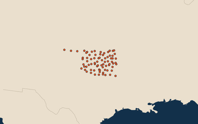
Counties of Oklahoma
77 counties, each one drawn on a satellite globe. Name it when it lights up, find it when you are given its name, or type every one you can remember in Name all.
Free to play, with no account needed. What you miss comes back for review until it sticks.
The counties
- 1Osage County5,819 km²
- 2Texas County5,287 km²
- 3McCurtain County4,793 km²
- 4Cimarron County4,752 km²
- 5Beaver County4,700 km²
- 6Le Flore County4,117 km²
- 7Pushmataha County3,614 km²
- 8Pittsburg County3,381 km²
- 9Woods County3,332 km²
- 10Caddo County3,309 km²
- 11Woodward County3,219 km²
- 12Ellis County3,190 km²
- 13Roger Mills County2,956 km²
- 14Grady County2,850 km²
- 15Comanche County2,770 km²
- 16Garfield County2,742 km²
- 17Harper County2,690 km²
- 18Kiowa County2,629 km²
- 19Washita County2,598 km²
- 20Grant County2,592 km²
- 21Dewey County2,589 km²
- 22Custer County2,561 km²
- 23Atoka County2,526 km²
- 24Major County2,473 km²
- 25Lincoln County2,467 km²
- 26Creek County2,460 km²
- 27Blaine County2,405 km²
- 28Kay County2,382 km²
- 29Bryan County2,342 km²
- 30Beckham County2,335 km²
- 31Kingfisher County2,326 km²
- 32Canadian County2,322 km²
- 33Tillman County2,256 km²
- 34Stephens County2,254 km²
- 35Alfalfa County2,244 km²
- 36Carter County2,129 km²
- 37Muskogee County2,100 km²
- 38Hughes County2,084 km²
- 39Jackson County2,079 km²
- 40Garvin County2,078 km²
- 41Pottawatomie County2,040 km²
- 42Choctaw County1,995 km²
- 43Craig County1,972 km²
- 44Jefferson County1,966 km²
- 45Cherokee County1,940 km²
- 46Logan County1,926 km²
- 47Delaware County1,911 km²
- 48Noble County1,895 km²
- 49Latimer County1,870 km²
- 50Pontotoc County1,866 km²
- 51Oklahoma County1,836 km²
- 52Okmulgee County1,806 km²
- 53Payne County1,774 km²
- 54Rogers County1,750 km²
- 55Sequoyah County1,745 km²
- 56Mayes County1,697 km²
- 57Johnston County1,665 km²
- 58Greer County1,656 km²
- 59Cotton County1,639 km²
- 60Seminole County1,639 km²
and 17 more, all in the quiz.
Second-level units: the 3135 counties, within the 51 states (the first level), which the region hint names. Area in km²: the official area where the national statistics office gives one (countries whose divisions changed since Natural Earth). Each item names its source. Sources: OpenStreetMap (ODbL), national statistics offices.
On the map
More in Oklahoma
- 10 largest cities in Oklahoma
- 6 largest natural lakes in Oklahoma
- 12 longest rivers in Oklahoma
- 16 largest lakes and reservoirs in Oklahoma