GeotchaA geography quiz on a real globe
Counties of North Carolina
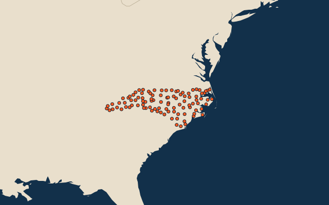
100 counties, each one drawn on a satellite globe. Name it when it lights up, find it when you are given its name, or type every one you can remember in Name all.
Free to play, with no account needed. What you miss comes back for review until it sticks.
The counties
- 1Robeson County2,453 km²
- 2Sampson County2,450 km²
- 3Columbus County2,430 km²
- 4Bladen County2,266 km²
- 5Pender County2,257 km²
- 6Brunswick County2,202 km²
- 7Wake County2,162 km²
- 8Beaufort County2,157 km²
- 9Duplin County2,110 km²
- 10Johnston County2,051 km²
- 11Randolph County2,026 km²
- 12Onslow County1,974 km²
- 13Wilkes County1,952 km²
- 14Halifax County1,874 km²
- 15Craven County1,830 km²
- 16Bertie County1,811 km²
- 17Moore County1,807 km²
- 18Chatham County1,766 km²
- 19Buncombe County1,700 km²
- 20Cumberland County1,690 km²
- 21Pitt County1,690 km²
- 22Guilford County1,673 km²
- 23Union County1,639 km²
- 24Hyde County1,586 km²
- 25Harnett County1,541 km²
- 26Iredell County1,488 km²
- 27Rockingham County1,465 km²
- 28Rutherford County1,464 km²
- 29Wayne County1,435 km²
- 30Haywood County1,434 km²
- 31Davidson County1,433 km²
- 32Nash County1,400 km²
- 33Northampton County1,390 km²
- 34Surry County1,380 km²
- 35Granville County1,378 km²
- 36Anson County1,376 km²
- 37Swain County1,367 km²
- 38Mecklenburg County1,356 km²
- 39Macon County1,335 km²
- 40Rowan County1,325 km²
- 41Carteret County1,315 km²
- 42Burke County1,311 km²
- 43Edgecombe County1,309 km²
- 44Franklin County1,274 km²
- 45Montgomery County1,273 km²
- 46Jackson County1,272 km²
- 47Richmond County1,227 km²
- 48Caldwell County1,222 km²
- 49Jones County1,221 km²
- 50Cleveland County1,202 km²
- 51Martin County1,182 km²
- 52Cherokee County1,180 km²
- 53Madison County1,164 km²
- 54Stokes County1,164 km²
- 55McDowell County1,139 km²
- 56Warren County1,112 km²
- 57Ashe County1,104 km²
- 58Caswell County1,102 km²
- 59Alamance County1,097 km²
- 60Forsyth County1,056 km²
and 40 more, all in the quiz.
Second-level units: the 3135 counties, within the 51 states (the first level), which the region hint names. Area in km²: the official area where the national statistics office gives one (countries whose divisions changed since Natural Earth). Each item names its source. Sources: OpenStreetMap (ODbL), national statistics offices.
On the map
More in North Carolina
- 10 largest cities in North Carolina
- 12 largest lakes and reservoirs in North Carolina
- 16 longest rivers in North Carolina
- 6 highest peaks in North Carolina
- 10 largest islands in North Carolina