GeotchaA geography quiz on a real globe
Counties of Montana
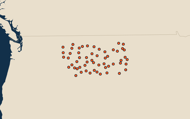
56 counties, each one drawn on a satellite globe. Name it when it lights up, find it when you are given its name, or type every one you can remember in Name all.
Free to play, with no account needed. What you miss comes back for review until it sticks.
The counties
- 1Beaverhead County14,355 km²
- 2Phillips County13,314 km²
- 3Flathead County13,176 km²
- 4Rosebud County12,971 km²
- 5Big Horn County12,944 km²
- 6Valley County12,759 km²
- 7Garfield County12,112 km²
- 8Fergus County11,239 km²
- 9Blaine County10,949 km²
- 10Chouteau County10,289 km²
- 11Custer County9,799 km²
- 12Lincoln County9,356 km²
- 13Madison County9,293 km²
- 14Lewis and Clark County8,957 km²
- 15Carter County8,652 km²
- 16Powder River County8,542 km²
- 17Glacier County7,757 km²
- 18Hill County7,509 km²
- 19Park County7,258 km²
- 20Sanders County7,149 km²
- 21Cascade County6,988 km²
- 22McCone County6,843 km²
- 23Yellowstone County6,821 km²
- 24Gallatin County6,748 km²
- 25Missoula County6,716 km²
- 26Meagher County6,195 km²
- 27Ravalli County6,193 km²
- 28Dawson County6,143 km²
- 29Roosevelt County6,098 km²
- 30Powell County6,024 km²
- 31Teton County5,883 km²
- 32Richland County5,399 km²
- 33Carbon County5,304 km²
- 34Toole County4,959 km²
- 35Judith Basin County4,842 km²
- 36Musselshell County4,841 km²
- 37Sweet Grass County4,806 km²
- 38Stillwater County4,654 km²
- 39Prairie County4,498 km²
- 40Granite County4,473 km²
- 41Sheridan County4,343 km²
- 42Jefferson County4,292 km²
- 43Petroleum County4,288 km²
- 44Pondera County4,208 km²
- 45Fallon County4,197 km²
- 46Lake County3,860 km²
- 47Liberty County3,704 km²
- 48Daniels County3,694 km²
- 49Wheatland County3,684 km²
- 50Mineral County3,159 km²
- 51Broadwater County3,088 km²
- 52Golden Valley County3,042 km²
- 53Treasure County2,532 km²
- 54Wibaux County2,304 km²
- 55Deer Lodge County1,908 km²
- 56Silver Bow County1,860 km²
Second-level units: the 3135 counties, within the 51 states (the first level), which the region hint names. Area in km²: the official area where the national statistics office gives one (countries whose divisions changed since Natural Earth). Each item names its source. Sources: OpenStreetMap (ODbL), national statistics offices.
On the map
More in Montana
- 8 largest cities in Montana, United States
- 11 largest lakes and reservoirs in Montana, United States
- 25 longest rivers in Montana, United States
- 24 highest peaks in Montana, United States