GeotchaA geography quiz on a real globe
50 largest islands in the Lesser Sunda Islands
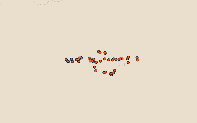
50 islands, each one drawn on a satellite globe. Name it when it lights up, find it when you are given its name, or type every one you can remember in Name all.
Free to start: a few quizzes a day cost nothing, and Geotcha Plus opens every quiz. What you miss comes back for review until it sticks.
The full list
About this quiz
Timor is the largest of the 50 islands in this quiz, at 30,777 km²; Gili Air is the smallest listed, at 2 km². Timor's area is about twice Sumbawa's (14,386 km²). The three largest hold 66% of the combined area of all 50. Indonesia has 47 of the 50, in a list that spans two countries.
What they are known for
- Timor: Shared by Indonesia and a young Catholic-majority nation that voted to leave Indonesia in 1999 and became independent in 2002.
- Sumbawa: Home of the volcano Tambora, whose 1815 eruption darkened skies around the world.
- Flores: Fossils of a metre-tall extinct human species, nicknamed the hobbit, were found here in 2003.
- Sumba: Indonesian island known for megalithic tombs, horse jousting (Pasola) and ikat textiles.
- Bali: Hindu-majority island of Indonesia, famous for terraced rice fields and temples.
The islands
- 1Timor Timor-Leste30,777 km²
- 2Sumbawa Indonesia14,386 km²
- 3Flores Indonesia13,540 km²
- 4Sumba Indonesia10,711 km²
- 5Bali Indonesia5,633 km²
- 6Lombok Indonesia4,514 km²
- 7Alor Island Indonesia2,120 km²
- 8Lembata Indonesia1,270 km²
- 9Rote Island Indonesia1,227 km²
- 10Pantar Indonesia720 km²
- 11Adonara Indonesia507 km²
- 12Komodo Indonesia390 km²
- 13Sabu Island Indonesia380 km²
- 14Moyo Island Indonesia330 km²
- 15Semau Indonesia220 km²
- 16Solor Indonesia216 km²
- 17Rinca Indonesia204 km²
- 18Nusapenida Island Indonesia203 km²
- 19Tanajampea Island Indonesia163 km²
- 20Sanghyang Island Indonesia153 km²
- 21Atauro Timor-Leste140 km²
- 22Kalao Island Indonesia110 km²
- 23Kisar Indonesia82 km²
- 24Kalaotoa Island Indonesia78 km²
- 25Besar Island Indonesia52 km²
- 26Palue Island Indonesia39 km²
- 27Raijua Indonesia37 km²
- 28Panjang Island (West Nusa Tenggara) Indonesia31 km²
- 29Gili Motang Indonesia30 km²
- 30Pura Island Indonesia28 km²
- 31Gili Banta Indonesia25 km²
- 32Lirang Island Indonesia23 km²
- 33Mules Island Indonesia18 km²
- 34Ndana Island Indonesia14 km²
- 35Padar Besar Island Indonesia13 km²
- 36Saringgit Dua Island Indonesia13 km²
- 37Tepulimabole Island Indonesia13 km²
- 38Karumpalompo Island Indonesia12 km²
- 39Medang Island Indonesia10 km²
- 40Ndao Island Indonesia9 km²
- 41Nusa Lembongan Indonesia9 km²
- 42Jaco Timor-Leste8 km²
- 43Seraya Besar Island Indonesia7 km²
- 44Halura Island Indonesia6 km²
- 45Nuse Island Indonesia6 km²
- 46Kamara Island Indonesia5 km²
- 47Satonda Island Indonesia5 km²
- 48Gili Trawangan Indonesia3 km²
- 49Nusa Ceningan Indonesia3 km²
- 50Gili Air Indonesia2 km²
On the map
More in Lesser Sunda Islands
Similar quizzes
- 50 largest islands in the Pacific Islands
- 50 largest islands in the Malay Archipelago
- 50 largest islands in Melanesia
- 50 largest islands in the British Isles
- 50 largest islands in the Sunda Islands
- 50 largest islands in Polynesia
- 50 largest islands in the Arctic Archipelago
- 50 largest islands in the Greater Sunda Islands
The whole world
How the figures are measured
Land area in km²: the Largest Islands set’s figure for its islands, else Wikidata’s (P2046) where it fits the outline, else the area of the outline. Every island Natural Earth draws at 1:10m that Wikidata names, of 5 km² or more (smaller ones when well known), and every island of the Largest Islands set. Countries are those the island’s land lies in, from the outlines. The Lesser Sunda Islands: the 51 islands of the island group, its smaller groups included (the islands pool's islands only).