GeotchaA geography quiz on a real globe
50 largest islands in Polynesia
50 islands, each one drawn on a satellite globe. Name it when it lights up, find it when you are given its name, or type every one you can remember in Name all.
Free to start: a few quizzes a day cost nothing, and Geotcha Plus opens every quiz. What you miss comes back for review until it sticks.
The full list
About this quiz
South Island is the largest of the 50 islands in this quiz, at 150,437 km²; Eiao is the smallest listed, at 44 km². The three largest hold 94% of the combined area of all 50. They lie in nine countries; France has the most, with 18.
What they are known for
- South Island: Home to Aoraki Mount Cook, Fiordland and Queenstown; the larger but less populous main island of its country.
- North Island: Holds Auckland, Wellington, geothermal Rotorua and the supervolcano under Lake Taupō; most New Zealanders live here.
- Hawaiʻi: Youngest island of its US chain, still growing from lava flows; Mauna Kea rises over 10,000 m from the sea floor.
The islands
- 1South Island New Zealand150,437 km²
- 2North Island New Zealand113,729 km²
- 3Hawaiʻi United States10,434 km²
- 4Maui United States1,883 km²
- 5Stewart Island New Zealand1,746 km²
- 6Savai'i Samoa1,718 km²
- 7Oahu United States1,545 km²
- 8Kauai United States1,435 km²
- 9Upolu Samoa1,125 km²
- 10Tahiti France1,042 km²
- 11Chatham Island New Zealand920 km²
- 12Molokai United States673 km²
- 13Kiritimati Kiribati388 km²
- 14Lanai United States364 km²
- 15Nuku Hiva France339 km²
- 16Hiva-Oa France316 km²
- 17Great Barrier Island New Zealand285 km²
- 18Niue260 km²
- 19Tongatapu Tonga260 km²
- 20Resolution Island New Zealand208 km²
- 21Niihau United States180 km²
- 22Raiatea France175 km²
- 23Easter Island Chile164 km²
- 24D'Urville Island (New Zealand) New Zealand150 km²
- 25Suwarrow Cook Islands150 km²
- 26Tutuila United States140 km²
- 27Moorea France134 km²
- 28Kahoolawe United States116 km²
- 29Manuae France114 km²
- 30Ua Pou France105 km²
- 31Waiheke Island New Zealand92 km²
- 32Tahaa France90 km²
- 33Vava’u Island Tonga90 km²
- 34'Eua Tonga87 km²
- 35Fatu Hiva France84 km²
- 36Ua Huka France83 km²
- 37Secretary Island New Zealand81 km²
- 38Rangiroa France79 km²
- 39Wallis France78 km²
- 40Arapaoa Island New Zealand75 km²
- 41Pitt Island New Zealand62 km²
- 42Tahuata France61 km²
- 43Alofi Island France60 km²
- 44Matakana Island New Zealand60 km²
- 45Makemo France56 km²
- 46Tofua Tonga56 km²
- 47Niuafo'ou Tonga52 km²
- 48Futuna France46 km²
- 49Tubuai France45 km²
- 50Eiao France44 km²
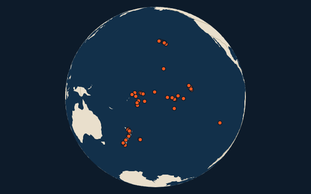
On the map
More in Polynesia
Similar quizzes
- 50 largest islands in the Pacific Islands
- 50 largest islands in the Malay Archipelago
- 50 largest islands in Melanesia
- 50 largest islands in the British Isles
- 50 largest islands in the Sunda Islands
- 50 largest islands in the Arctic Archipelago
- 50 largest islands in the Greater Sunda Islands
- 50 largest islands in the West Indies
The whole world
How the figures are measured
Land area in km²: the Largest Islands set’s figure for its islands, else Wikidata’s (P2046) where it fits the outline, else the area of the outline. Every island Natural Earth draws at 1:10m that Wikidata names, of 5 km² or more (smaller ones when well known), and every island of the Largest Islands set. Countries are those the island’s land lies in, from the outlines. Polynesia: the 258 islands of the island group, its smaller groups included (the islands pool's islands only).