GeotchaA geography quiz on a real globe
50 largest islands in the Lesser Antilles
50 islands, each one drawn on a satellite globe. Name it when it lights up, find it when you are given its name, or type every one you can remember in Name all.
Free to start: a few quizzes a day cost nothing, and Geotcha Plus opens every quiz. What you miss comes back for review until it sticks.
The full list
About this quiz
Trinidad is the largest of the 50 islands in this quiz, at 4,768 km²; Cayo Sal is the smallest listed, at 6 km². Trinidad's area is 4.2 times Martinique's (1,128 km²). The three largest hold 48% of the combined area of all 50. They lie in 15 countries; Venezuela has the most, with nine.
The islands
- 1Trinidad Trinidad and Tobago4,768 km²
- 2Martinique France1,128 km²
- 3Margarita Island Venezuela1,020 km²
- 4Basse-Terre Island France876 km²
- 5Dominica742 km²
- 6Saint Lucia640 km²
- 7Grande-Terre France639 km²
- 8Curaçao Netherlands444 km²
- 9Barbados439 km²
- 10Saint Vincent Saint Vincent and the Grenadines345 km²
- 11Grenada311 km²
- 12Tobago Trinidad and Tobago300 km²
- 13Bonaire Netherlands288 km²
- 14Antigua Antigua and Barbuda281 km²
- 15Saint Croix United States215 km²
- 16Aruba179 km²
- 17Marie-Galante France171 km²
- 18Saint Kitts Saint Kitts and Nevis168 km²
- 19Barbuda Antigua and Barbuda161 km²
- 20La Tortuga Island Venezuela157 km²
- 21Vieques United States136 km²
- 22Montserrat United Kingdom102 km²
- 23Nevis Saint Kitts and Nevis93 km²
- 24Anguilla United Kingdom91 km²
- 25Saint Martin France87 km²
- 26Saint Thomas United States81 km²
- 27Blanquilla Island Venezuela65 km²
- 28Coche Island Venezuela61 km²
- 29Tortola United Kingdom56 km²
- 30Saint John United States51 km²
- 31La Orchila Venezuela46 km²
- 32Anegada United Kingdom39 km²
- 33Carriacou Grenada34 km²
- 34Culebra United States27 km²
- 35Saint Barthélemy France24 km²
- 36Cubagua Venezuela22 km²
- 37La Désirade France21 km²
- 38Sint Eustatius Netherlands21 km²
- 39Virgin Gorda United Kingdom21 km²
- 40Bequia Saint Vincent and the Grenadines18 km²
- 41Cayo Grande Venezuela15 km²
- 42Saba Netherlands13 km²
- 43Terre-de-Bas Island France9 km²
- 44Canouan Saint Vincent and the Grenadines8 km²
- 45Jost Van Dyke United Kingdom8 km²
- 46Ronde Island Grenada8 km²
- 47Union Island Saint Vincent and the Grenadines8 km²
- 48Peter Island British Virgin Islands7 km²
- 49Cayo Largo Venezuela6 km²
- 50Cayo Sal Venezuela6 km²
On the map
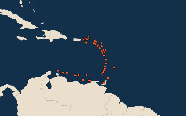
More in Lesser Antilles
Similar quizzes
- 50 largest islands in the Pacific Islands
- 50 largest islands in the Malay Archipelago
- 50 largest islands in Melanesia
- 50 largest islands in the British Isles
- 50 largest islands in the Sunda Islands
- 50 largest islands in Polynesia
- 50 largest islands in the Arctic Archipelago
- 50 largest islands in the Greater Sunda Islands
The whole world
How the figures are measured
Land area in km²: the Largest Islands set’s figure for its islands, else Wikidata’s (P2046) where it fits the outline, else the area of the outline. Every island Natural Earth draws at 1:10m that Wikidata names, of 5 km² or more (smaller ones when well known), and every island of the Largest Islands set. Countries are those the island’s land lies in, from the outlines. The Lesser Antilles: the 87 islands of the island group, its smaller groups included (the islands pool's islands only).