GeotchaA geography quiz on a real globe
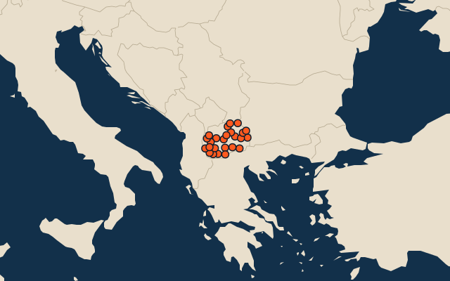
25 largest regions with Macedonian as an official language
25 regions, each one drawn on a satellite globe. Name it when it lights up, find it when you are given its name, tell its flag from three others, or type every one you can remember in Name all.
Free to play, with no account needed. What you miss comes back for review until it sticks.
The regions
- 1Prilep1,234 km²
- 2Kavadarci980 km²
- 3Makedonski Brod891 km²
- 4Čaška818 km²
- 5Kičevo818 km²
- 6Bitola788 km²
- 7Novaci756 km²
- 8Resen740 km²
- 9Mavrovo i Rostuše678 km²
- 10Berovo599 km²
- 11Ohrid589 km²
- 12Štip578 km²
- 13Struga539 km²
- 14Gostivar513 km²
- 15Kumanovo506 km²
- 16Radoviš498 km²
- 17Kriva Palanka480 km²
- 18Gevgelija479 km²
- 19Sveti Nikole479 km²
- 20Demir Hisar474 km²
- 21Vinica433 km²
- 22Staro Nagoričane432 km²
- 23Veles429 km²
- 24Delčevo421 km²
- 25Debarca419 km²
Area in km²: else the area measured on the outline. Each item names its source. Official languages: official nationally, as the Unicode CLDR territory data and the CIA World Factbook record them; a city or region counts with its own official languages, else those of the region or country it lies in. Sources: OpenStreetMap (ODbL).
On the map
Similar quizzes
- 25 largest regions with English as an official language
- 25 largest regions with French as an official language
- 25 largest regions with Spanish as an official language
- 25 largest regions with Chinese as an official language
- 25 largest regions with Hindi as an official language
- 25 largest regions with Arabic as an official language
- 13 largest regions with Urdu as an official language
- 25 largest regions with Portuguese as an official language
- 25 largest regions with German as an official language
- 25 largest regions with Russian as an official language
- US states