GeotchaA geography quiz on a real globe
25 largest regions with Spanish as an official language
25 regions, each one drawn on a satellite globe. Name it when it lights up, find it when you are given its name, tell its flag from three others, or type every one you can remember in Name all.
Free to start: a few quizzes a day cost nothing, and Geotcha Plus opens every quiz. What you miss comes back for review until it sticks.
The full list
About this quiz
Santa Cruz (Bolivia) is the largest of the 25 regions in this quiz, at 370,621 km²; Aysén is the smallest listed, at 108,494 km². The three largest hold 22% of the combined area of all 25. They lie in seven countries; Argentina has the most, with ten.
What they are known for
- Santa Cruz (Bolivia): A tropical commercial metropolis, Jesuit mission churches and Amboró forests define the eastern lowlands.
- Loreto: Largest department, only reachable by river or air; Iquitos sits in the Amazon rainforest.
- Buenos Aires Province: Home of the pampas, gauchos and Mar del Plata beaches; its capital is La Plata, and it borders the federal capital.
- Chihuahua: Largest state by land, with the Copper Canyon railway and Pancho Villa's old territory.
- Santa Cruz (Argentina): Southern Patagonian province of the Perito Moreno Glacier, Monte Fitz Roy and El Calafate.
- Bolívar: Angel Falls plunges from a tabletop mountain in Canaima National Park.
- Chubut: Patagonian province of Welsh settlements, Puerto Madryn and whales and penguins of the Valdés Peninsula.
- Beni: Trinidad anchors tropical savannas, river wetlands and the cattle-ranching lowlands of the northeast.
The regions
- 1Santa Cruz (Bolivia) Bolivia370,621 km²
- 2Loreto Peru368,773 km²
- 3Buenos Aires Province Argentina307,571 km²
- 4Chihuahua Mexico247,455 km²
- 5Santa Cruz (Argentina) Argentina243,943 km²
- 6Bolívar Venezuela240,528 km²
- 7Chubut Argentina224,686 km²
- 8Beni Bolivia213,564 km²
- 9Río Negro Argentina203,013 km²
- 10Sonora Mexico179,503 km²
- 11Amazonas (Venezuela) Venezuela177,617 km²
- 12Córdoba Argentina165,321 km²
- 13Salta Argentina155,488 km²
- 14Coahuila Mexico151,595 km²
- 15Mendoza Argentina148,827 km²
- 16La Pampa Argentina143,440 km²
- 17Santiago del Estero Argentina136,351 km²
- 18La Paz Bolivia133,985 km²
- 19Santa Fe Argentina133,007 km²
- 20Magellan and the Chilean Antarctic Chile132,291 km²
- 21Antofagasta Chile126,049 km²
- 22Durango Mexico123,317 km²
- 23Potosí Bolivia118,218 km²
- 24Amazonas (Colombia) Colombia109,665 km²
- 25Aysén Chile108,494 km²
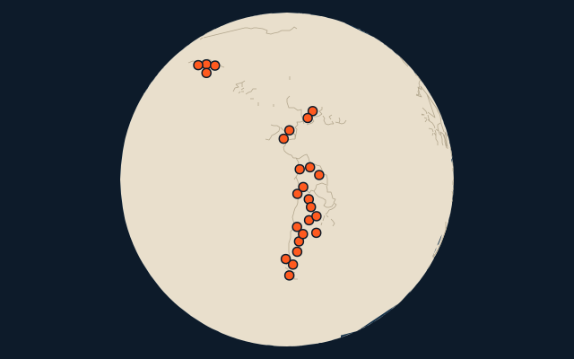
On the map
More in Spanish
- Countries with Spanish as an official language
- 25 largest cities where Spanish is spoken
- Countries where Spanish is the most spoken language
Similar quizzes
- 25 largest regions with English as an official language
- 25 largest regions with French as an official language
- 25 largest regions with Hindi as an official language
- 25 largest regions with Chinese as an official language
- 25 largest regions with Arabic as an official language
- 13 largest regions with Urdu as an official language
- 25 largest regions with Portuguese as an official language
- 25 largest regions with German as an official language
How the figures are measured
Area in km²: Wikidata’s figure (P2046, the whole or the land area, whichever matches the outline) where it is within a factor of two of the outline’s area. Each item names its source. Official languages: official nationally, as the Unicode CLDR territory data and the CIA World Factbook record them; a city or region counts with its own official languages, else those of the region or country it lies in.