GeotchaA geography quiz on a real globe
25 largest regions with Hindi as an official language
25 regions, each one drawn on a satellite globe. Name it when it lights up, find it when you are given its name, or type every one you can remember in Name all.
Free to start: a few quizzes a day cost nothing, and Geotcha Plus opens every quiz. What you miss comes back for review until it sticks.
The full list
About this quiz
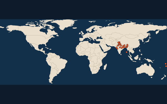
Rajasthan is the largest of the 25 regions in this quiz, at 342,269 km²; Rotuma is the smallest listed, at 46 km². The three largest hold 47% of the combined area of all 25. India has 23 of the 25, in a list that spans two countries.
What they are known for
- Rajasthan: Desert state of the Thar, with forts, Jaipur's pink city, Udaipur's lakes, camel fairs and tiger reserve at Ranthambore.
- Madhya Pradesh: Central heart of India with Khajuraho temples, Sanchi stupa, Kanha and Bandhavgarh tiger reserves.
- Uttar Pradesh: Most populous state, with the Taj Mahal, holy Varanasi on the Ganges, Ayodhya and Lucknow's kebabs.
- Gujarat: Western state of the Asiatic lions at Gir, Gandhi's birthplace, the Statue of Unity and Rann salt flats.
- Chhattisgarh: Central state of tribal forests, rich in iron ore and coal, with the Bastar region and a rice bowl reputation.
- Bihar: Eastern Gangetic plain state of Bodh Gaya, where Buddha attained enlightenment, ancient Nalanda and Chhath festival.
- West Bengal: Eastern state of Kolkata, Darjeeling tea, the Sundarbans mangrove tigers, rasgulla sweets and Durga Puja.
- Arunachal Pradesh: Easternmost mountain state on the Chinese border, with Tawang monastery and the first sunrise of India.
The regions
- 1Rajasthan India342,269 km²
- 2Madhya Pradesh India308,245 km²
- 3Uttar Pradesh India243,290 km²
- 4Gujarat India196,024 km²
- 5Chhattisgarh India135,194 km²
- 6Bihar India94,163 km²
- 7West Bengal India88,752 km²
- 8Arunachal Pradesh India83,743 km²
- 9Jharkhand India79,714 km²
- 10Ladakh India59,196 km²
- 11Himachal Pradesh India55,780 km²
- 12Uttarakhand India53,566 km²
- 13Haryana India44,212 km²
- 14Jammu and Kashmir India42,241 km²
- 15Manipur India22,327 km²
- 16Mizoram India21,081 km²
- 17Nagaland India16,579 km²
- 18Tripura India10,486 km²
- 19Andaman and Nicobar Islands India8,249 km²
- 20Sikkim India7,096 km²
- 21Western Fiji6,609 km²
- 22Delhi India1,484 km²
- 23Dadra and Nagar Haveli and Daman and Diu India603 km²
- 24Chandigarh India114 km²
- 25Rotuma Fiji46 km²
On the map
More in Hindi
Similar quizzes
- 25 largest regions with English as an official language
- 25 largest regions with French as an official language
- 25 largest regions with Spanish as an official language
- 25 largest regions with Chinese as an official language
- 25 largest regions with Arabic as an official language
- 13 largest regions with Urdu as an official language
- 25 largest regions with Portuguese as an official language
- 25 largest regions with German as an official language
How the figures are measured
Area in km²: Wikidata’s figure (P2046, the whole or the land area, whichever matches the outline) where it is within a factor of two of the outline’s area; else the area measured on the outline. Each item names its source. Official languages: official nationally, as the Unicode CLDR territory data and the CIA World Factbook record them; a city or region counts with its own official languages, else those of the region or country it lies in.