GeotchaA geography quiz on a real globe
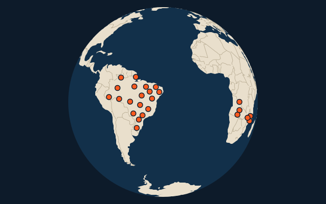
25 largest regions with Portuguese as an official language
25 regions, each one drawn on a satellite globe. Name it when it lights up, find it when you are given its name, tell its flag from three others, or type every one you can remember in Name all.
Free to play, with no account needed. What you miss comes back for review until it sticks.
The regions
- 1Amazonas1,559,168 km²
- 2Pará1,245,871 km²
- 3Mato Grosso903,357 km²
- 4Minas Gerais586,514 km²
- 5Bahia565,733 km²
- 6Mato Grosso do Sul357,146 km²
- 7Goiás340,086 km²
- 8Maranhão331,983 km²
- 9Rio Grande do Sul281,707 km²
- 10Tocantins278,421 km²
- 11Piauí251,756 km²
- 12São Paulo248,209 km²
- 13Rondônia237,765 km²
- 14Roraima223,645 km²
- 15Moxico223,023 km²
- 16Paraná199,315 km²
- 17Cuando Cubango199,049 km²
- 18Acre152,581 km²
- 19Ceará146,348 km²
- 20Amapá142,815 km²
- 21Niassa122,827 km²
- 22Lunda Norte103,760 km²
- 23Zambezia103,478 km²
- 24Pernambuco98,938 km²
- 25Tete98,417 km²
Area in km²: Wikidata’s figure (P2046, the whole or the land area, whichever matches the outline) where it is within a factor of two of the outline’s area. Each item names its source. Official languages: official nationally, as the Unicode CLDR territory data and the CIA World Factbook record them; a city or region counts with its own official languages, else those of the region or country it lies in. Sources: OpenStreetMap (ODbL), Wikidata (CC0).
On the map
More in Portuguese
- Countries with Portuguese as an official language
- 25 largest cities where Portuguese is spoken
- Countries where Portuguese is the most spoken language
Similar quizzes
- 25 largest regions with English as an official language
- 25 largest regions with French as an official language
- 25 largest regions with Spanish as an official language
- 25 largest regions with Arabic as an official language
- 25 largest regions with German as an official language
- 25 largest regions with Russian as an official language
- 25 largest regions with Chinese as an official language
- 25 largest regions with Italian as an official language
- 25 largest regions with Dutch as an official language
- 25 largest regions with Swahili as an official language
- US states