GeotchaA geography quiz on a real globe
25 largest regions with Japanese as an official language
25 regions, each one drawn on a satellite globe. Name it when it lights up, find it when you are given its name, tell its flag from three others, or type every one you can remember in Name all.
Free to play, with no account needed. What you miss comes back for review until it sticks.
The regions
- 1Dornogovi109,472 km²
- 2Hokkaidō77,984 km²
- 3Iwate Prefecture15,275 km²
- 4Fukushima Prefecture13,784 km²
- 5Nagano Prefecture13,585 km²
- 6Niigata Prefecture12,582 km²
- 7Akita Prefecture11,638 km²
- 8Gifu Prefecture10,621 km²
- 9Aomori Prefecture9,646 km²
- 10Yamagata Prefecture9,323 km²
- 11Kagoshima Prefecture9,132 km²
- 12Hiroshima Prefecture8,477 km²
- 13Hyōgo Prefecture8,401 km²
- 14Shizuoka Prefecture7,780 km²
- 15Miyazaki Prefecture7,736 km²
- 16Kumamoto Prefecture7,404 km²
- 17Miyagi Prefecture7,282 km²
- 18Okayama Prefecture7,113 km²
- 19Kōchi Prefecture7,104 km²
- 20Shimane Prefecture6,708 km²
- 21Tochigi Prefecture6,408 km²
- 22Gunma Prefecture6,362 km²
- 23Ōita Prefecture6,341 km²
- 24Yamaguchi Prefecture6,111 km²
- 25Ibaraki Prefecture6,097 km²
Area in km²: Wikidata’s figure (P2046, the whole or the land area, whichever matches the outline) where it is within a factor of two of the outline’s area. Each item names its source. Official languages: official nationally, as the Unicode CLDR territory data and the CIA World Factbook record them; a city or region counts with its own official languages, else those of the region or country it lies in. Sources: OpenStreetMap (ODbL), Wikidata (CC0).
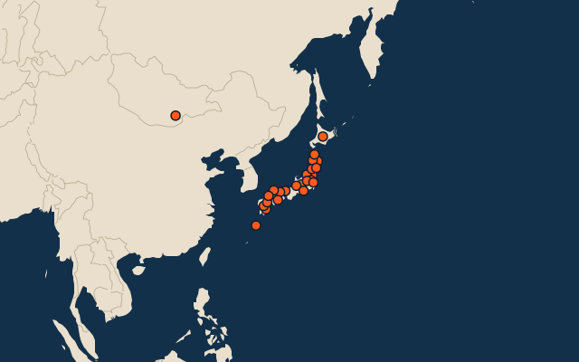
On the map
More in Japanese
Similar quizzes
- 25 largest regions with English as an official language
- 25 largest regions with French as an official language
- 25 largest regions with Spanish as an official language
- 25 largest regions with Chinese as an official language
- 25 largest regions with Hindi as an official language
- 25 largest regions with Arabic as an official language
- 13 largest regions with Urdu as an official language
- 25 largest regions with Portuguese as an official language
- 25 largest regions with German as an official language
- 25 largest regions with Russian as an official language
- US states