GeotchaA geography quiz on a real globe
25 largest islands in Scandinavia
25 islands, each one drawn on a satellite globe. Name it when it lights up, find it when you are given its name, or type every one you can remember in Name all.
Free to play, with no account needed. What you miss comes back for review until it sticks.
The islands
- 1Nordaustlandet14,443 km²
- 2Zealand7,031 km²
- 3Edgeøya5,073 km²
- 4North Jutlandic Island4,686 km²
- 5Funen2,985 km²
- 6Gotland2,968 km²
- 7Hinnøya2,198 km²
- 8Senja1,590 km²
- 9Öland1,347 km²
- 10Barentsøya1,288 km²
- 11Lolland1,243 km²
- 12Södertörn1,207 km²
- 13Langøya860 km²
- 14Sørøya816 km²
- 15Kvaløya, Troms737 km²
- 16Ringvassøya656 km²
- 17Bornholm588 km²
- 18Hitra572 km²
- 19Seiland559 km²
- 20Austvågøya527 km²
- 21Falster514 km²
- 22Andøya489 km²
- 23Magerøya436 km²
- 24Vestvågøya411 km²
- 25Jan Mayen377 km²
Land area in km²: the Largest Islands set’s figure for its islands, else Wikidata’s (P2046) where it fits the outline, else the area of the outline. Every island Natural Earth draws at 1:10m that Wikidata names, of 5 km² or more (smaller ones when well known), and every island of the Largest Islands set. Countries are those the island’s land lies in, from the outlines. Scandinavia: what lies inside the region’s outline, by each item’s point (a lake’s centre, a river’s mouth, a summit).
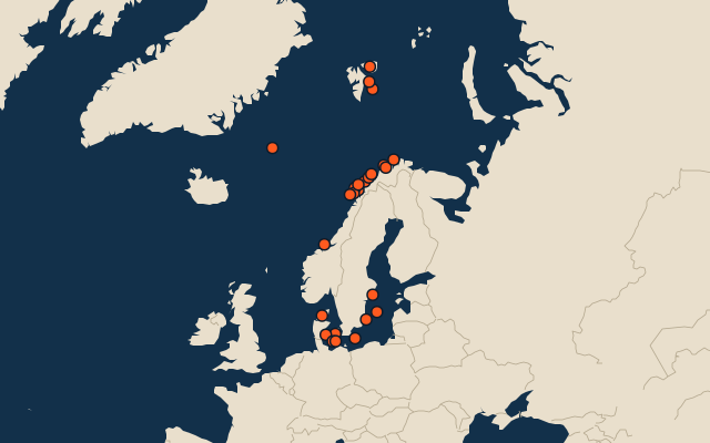
On the map
More in Scandinavia
- 25 largest cities in Scandinavia
- 25 largest lakes in Scandinavia
- 25 longest rivers in Scandinavia
- 25 highest peaks in Scandinavia
- 25 largest islands in Scandinavia
- 25 largest cities in Scandinavia
- 25 highest peaks in Scandinavia
Similar quizzes
- 50 largest islands in the Pacific Islands
- 50 largest islands in the Malay Archipelago
- 50 largest islands in Melanesia
- 50 largest islands in the British Isles
- 50 largest islands in the Sunda Islands
- 50 largest islands in Polynesia
- 50 largest islands in the Arctic Archipelago
- 50 largest islands in the Greater Sunda Islands
- 50 largest islands in the West Indies
- 50 largest islands in the Caribbean
- Largest islands