GeotchaA geography quiz on a real globe
21 largest regions with Tok Pisin as an official language
21 regions, each one drawn on a satellite globe. Name it when it lights up, find it when you are given its name, tell its flag from three others, or type every one you can remember in Name all.
Free to play, with no account needed. What you miss comes back for review until it sticks.
The regions
- 1Western98,943 km²
- 2East Sepik43,729 km²
- 3Sandaun36,148 km²
- 4Gulf34,606 km²
- 5Morobe33,976 km²
- 6Central29,521 km²
- 7Madang29,066 km²
- 8Oro22,860 km²
- 9West New Britain20,445 km²
- 10East New Britain15,371 km²
- 11Milne Bay14,233 km²
- 12Enga11,814 km²
- 13Eastern Highlands11,185 km²
- 14Hela10,580 km²
- 15New Ireland9,591 km²
- 16Bougainville9,448 km²
- 17Chimbu6,091 km²
- 18Jiwaka5,075 km²
- 19Western Highlands4,096 km²
- 20Manus2,130 km²
- 21National Capital District262 km²
Area in km²: else the area measured on the outline. Each item names its source. Official languages: official nationally, as the Unicode CLDR territory data and the CIA World Factbook record them; a city or region counts with its own official languages, else those of the region or country it lies in. Sources: OpenStreetMap (ODbL).
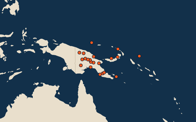
On the map
More in Tok Pisin
Similar quizzes
- 25 largest regions with English as an official language
- 25 largest regions with French as an official language
- 25 largest regions with Spanish as an official language
- 25 largest regions with Chinese as an official language
- 25 largest regions with Hindi as an official language
- 25 largest regions with Arabic as an official language
- 13 largest regions with Urdu as an official language
- 25 largest regions with Portuguese as an official language
- 25 largest regions with German as an official language
- 25 largest regions with Russian as an official language
- US states