GeotchaA geography quiz on a real globe
10 most populous counties of Kenya
10 counties, each one drawn on a satellite globe. Name it when it lights up, find it when you are given its name, tell its flag from three others, or type every one you can remember in Name all.
Free to start: a few quizzes a day cost nothing, and Geotcha Plus opens every quiz. What you miss comes back for review until it sticks.
The full list
About this quiz
Nairobi is the largest of the 10 counties in this quiz, at 5.3 M; Mombasa is the smallest listed, at 1.5 M. Nairobi's population is 1.8 times Kiambu's (2.9 M). The three largest hold 46% of the combined population of all 10.
What they are known for
- Nairobi: The capital, with a national park of lions against the skyline, the Giraffe Centre and Karen Blixen's house.
- Kiambu: Kikuyu coffee and tea highlands on the capital's northern edge, with Thika's pineapple farms.
- Nakuru: Rift Valley floor with a soda lake of flamingos and rhinos, and the vast Menengai crater.
- Kakamega: Remnant equatorial rainforest of rare birds and monkeys in the Luhya heartland of the west.
- Bungoma: Sugar cane and maize on the slopes of Mount Elgon, with Bukusu circumcision traditions and a Uganda border.
- Meru: Green eastern slopes of Mount Kenya: miraa farming and a national park, home of Elsa the lioness.
- Kilifi: Coast with Malindi's beaches, the Gedi ruins, Watamu turtles and the Mijikenda people.
- Machakos: Kamba trading county near the capital, with wood carvings and the planned Konza tech city.
The counties
- 1Nairobi5.3 M
- 2Kiambu2.9 M
- 3Nakuru2.6 M
- 4Kakamega2.3 M
- 5Bungoma2 M
- 6Meru1.9 M
- 7Kilifi1.8 M
- 8Machakos1.7 M
- 9Kisii1.5 M
- 10Mombasa1.5 M
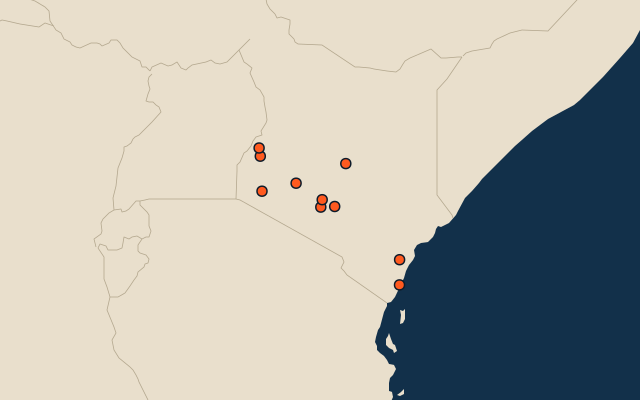
On the map
All of Africa
More in Kenya
- 25 largest cities in Kenya
- Counties of Kenya
- 10 largest lakes in Kenya
- 7 longest rivers in Kenya
- 22 highest peaks in Kenya
- 9 largest islands in Kenya
- 8 best known World Heritage Sites in Kenya
- 10 largest cities in Kenya
- Cities ranked 26–50 in Kenya
- County capitals of Kenya
Other countries of Africa
- States and the capital territory of Nigeria
- 10 most populous states and the capital territory of Nigeria
- Districts of Côte d'Ivoire
- 10 most populous districts of Côte d'Ivoire
- Provinces of South Africa
- 9 most populous provinces of South Africa
- Provinces of Algeria
- 10 most populous provinces of Algeria
How the figures are measured
Population of each region: a 2025 estimate: the latest official figure (a census or an estimate, as each item names it) scaled with the rest of its country’s regions to the World Bank’s 2025 national total, so a country’s regions share one year. Each item names its source and year. Regions without a figure are left out.