GeotchaA geography quiz on a real globe
10 most populous provinces of Algeria
10 provinces, each one drawn on a satellite globe. Name it when it lights up, find it when you are given its name, or type every one you can remember in Name all.
Free to start: a few quizzes a day cost nothing, and Geotcha Plus opens every quiz. What you miss comes back for review until it sticks.
The full list
About this quiz
Algiers is the largest of the 10 provinces in this quiz, at 4.2 M; Béjaïa is the smallest listed, at 1.3 M. Algiers's population is about twice Sétif's (2.1 M). The three largest hold 46% of the combined population of all 10.
What they are known for
- Algiers: The national capital on a Mediterranean bay: the Casbah, Martyrs' Memorial and a whitewashed hillside skyline.
- Sétif: High-plateau grain hub near Roman Djemila, UNESCO ruins; scene of the 1945 uprising.
- Oran: Raï music's birthplace, with the Spanish-era fort of Santa Cruz above a Mediterranean port.
- Tizi Ouzou: Heart of Kabylie: Djurdjura peaks, Berber Kabyle culture, olive oil and fig groves.
- Blida: City of Roses at the foot of the Chrea mountains, with orange groves and nearby ski slopes.
- Chlef: Fertile coastal valley in the northwest that suffered big earthquakes in 1954 and 1980, growing citrus.
- Batna: Gateway to the Aures mountains: Roman Timgad, cedar forests and the Chaoui people.
- Constantine: City of bridges spanning a deep gorge, perched on a rock; once the Numidian capital Cirta.
The provinces
- 1Algiers4.2 M
- 2Sétif2.1 M
- 3Oran2 M
- 4Tizi Ouzou1.6 M
- 5Blida1.4 M
- 6Chlef1.4 M
- 7Batna1.3 M
- 8Constantine1.3 M
- 9Tlemcen1.3 M
- 10Béjaïa1.3 M
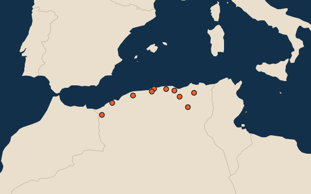
On the map
All of Africa
More in Algeria
- 25 largest cities in Algeria
- Provinces of Algeria
- 11 longest rivers in Algeria
- 10 highest peaks in Algeria
- 7 best known World Heritage Sites in Algeria
- 10 largest cities in Algeria
- Cities ranked 26–50 in Algeria
- Provincial capitals of Algeria
- Cities over 100,000 in Algeria
Other countries of Africa
- States and the capital territory of Nigeria
- 10 most populous states and the capital territory of Nigeria
- Districts of Côte d'Ivoire
- 10 most populous districts of Côte d'Ivoire
- Provinces of South Africa
- 9 most populous provinces of South Africa
- Governorates of Egypt
- 10 most populous governorates of Egypt
How the figures are measured
Population of each region: a 2025 estimate: the latest official figure (a census or an estimate, as each item names it) scaled with the rest of its country’s regions to the World Bank’s 2025 national total, so a country’s regions share one year. Each item names its source and year. Regions without a figure are left out.