GeotchaA geography quiz on a real globe
10 most populous governorates of Egypt
10 governorates, each one drawn on a satellite globe. Name it when it lights up, find it when you are given its name, tell its flag from three others, or type every one you can remember in Name all.
Free to start: a few quizzes a day cost nothing, and Geotcha Plus opens every quiz. What you miss comes back for review until it sticks.
The full list
About this quiz
Cairo is the largest of the 10 governorates in this quiz, at 11.9 M; Sohag is the smallest listed, at 6.2 M. The three largest hold 39% of the combined population of all 10.
What they are known for
- Cairo: The national capital: Tahrir Square, Islamic minarets, Khan el-Khalili bazaar and the Egyptian Museum.
- Giza: Great Pyramids and the Sphinx on the desert edge across the Nile from the capital.
- Sharqia: Eastern Delta farmland with ancient Bubastis, city of the cat goddess Bastet, and Zagazig's cotton trade.
- Dakahlia: Fertile Delta province whose Mansoura famously defeated a Crusader king in 1250.
- Beheira: Western Delta farmland with Rosetta, where the decipherment stone was found, and Coptic desert monasteries.
- Qalyubiyya: Industrial and farming belt just north of the capital, famed for Banha honey and orange orchards.
- Minya: Middle Egypt Nile city called Bride of the Upper, with Beni Hasan tombs and Akhenaten's capital at Amarna.
- Alexandria: Mediterranean port founded by a Macedonian conqueror, once home to a great lighthouse and library.
The governorates
- 1Cairo11.9 M
- 2Giza10.8 M
- 3Sharqia8.9 M
- 4Dakahlia8.1 M
- 5Beheira7.7 M
- 6Qalyubiyya7 M
- 7Minya6.9 M
- 8Alexandria6.4 M
- 9Gharbia6.2 M
- 10Sohag6.2 M
On the map
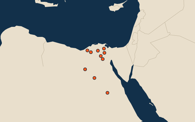
All of Africa
More in Egypt
- 25 largest cities in Egypt
- Governorates of Egypt
- 6 highest peaks in Egypt
- 9 largest islands in Egypt
- 7 best known World Heritage Sites in Egypt
- Flags of the governorates of Egypt
- 10 largest cities in Egypt
- 6 best known valleys in Egypt
- Cities ranked 26–50 in Egypt
- Governorate capitals of Egypt
Other countries of Africa
- States and the capital territory of Nigeria
- 10 most populous states and the capital territory of Nigeria
- Districts of Côte d'Ivoire
- 10 most populous districts of Côte d'Ivoire
- Provinces of South Africa
- 9 most populous provinces of South Africa
- Provinces of Algeria
- 10 most populous provinces of Algeria
How the figures are measured
Population of each region: a 2025 estimate: the latest official figure (a census or an estimate, as each item names it) scaled with the rest of its country’s regions to the World Bank’s 2025 national total, so a country’s regions share one year. Each item names its source and year. Regions without a figure are left out.