GeotchaA geography quiz on a real globe
10 most populous states and the capital territory of Nigeria
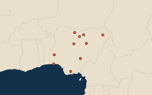
10 states and the capital territory, each one drawn on a satellite globe. Name it when it lights up, find it when you are given its name, tell its flag from three others, or type every one you can remember in Name all.
Free to start: a few quizzes a day cost nothing, and Geotcha Plus opens every quiz. What you miss comes back for review until it sticks.
The full list
About this quiz
Kano State is the largest of the 10 states and the capital territory in this quiz, at 19.6 M; Benue State is the smallest listed, at 7 M. The three largest hold 43% of the combined population of all 10.
What they are known for
- Kano State: Ancient walled Hausa merchant city with famous dye pits, a vast groundnut and leather trade.
- Lagos: Commercial hub of lagoon islands, Nollywood, Afrobeats and the country's busiest port.
- Kaduna State: Northern industrial hub with a rail junction, military academy, textile mills and Kajuru Castle.
- Katsina State: Ancient Hausa emirate on the northern border, with the Gobarau Minaret and a grand Durbar horse festival.
- Oyo State: Seat of the old Yoruba empire; its capital is a sprawling city with the early skyscraper Cocoa House.
- Rivers State: Oil-capital state with a major port city, refineries and the Bonny export terminal in the creeks.
- Bauchi State: Yankari National Park, with its warm springs and elephants, lies in this northeastern savanna state.
- Jigawa State: Hausa farming state in the north, with wetlands that draw migratory birds and rock-outcrop Dutse.
The states and the capital territory
- 1Kano State19.6 M
- 2Lagos13.4 M
- 3Kaduna State10 M
- 4Katsina State9.5 M
- 5Oyo State8.5 M
- 6Rivers State8.5 M
- 7Bauchi State8.3 M
- 8Jigawa State7.3 M
- 9Borno State7.1 M
- 10Benue State7 M
On the map
All of Africa
More in Nigeria
- 25 largest cities in Nigeria
- States and the capital territory of Nigeria
- 10 longest rivers in Nigeria
- 10 largest cities in Nigeria
- Cities ranked 26–50 in Nigeria
- State capitals of Nigeria
- Cities over 100,000 in Nigeria
Other countries of Africa
- Districts of Côte d'Ivoire
- 10 most populous districts of Côte d'Ivoire
- Provinces of South Africa
- 9 most populous provinces of South Africa
- Provinces of Algeria
- 10 most populous provinces of Algeria
- Governorates of Egypt
- 10 most populous governorates of Egypt
How the figures are measured
Population of each region: a 2025 estimate: the latest official figure (a census or an estimate, as each item names it) scaled with the rest of its country’s regions to the World Bank’s 2025 national total, so a country’s regions share one year. Each item names its source and year. Regions without a figure are left out.