GeotchaA geography quiz on a real globe
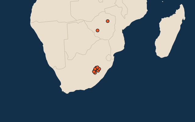
10 largest regions with Sesotho as an official language
10 regions, each one drawn on a satellite globe. Name it when it lights up, find it when you are given its name, or type every one you can remember in Name all.
Free to play, with no account needed. What you miss comes back for review until it sticks.
The regions
- 1Maseru4,279 km²
- 2Thaba-Tseka4,270 km²
- 3Mokhotlong4,075 km²
- 4Mohale's Hoek3,530 km²
- 5Leribe2,828 km²
- 6Berea2,222 km²
- 7Mafeteng2,119 km²
- 8Butha-Buthe1,767 km²
- 9Harare872 km²
- 10Bulawayo551 km²
Area in km²: Wikidata’s figure (P2046, the whole or the land area, whichever matches the outline) where it is within a factor of two of the outline’s area; else the area measured on the outline. Each item names its source. Official languages: official nationally, as the Unicode CLDR territory data and the CIA World Factbook record them; a city or region counts with its own official languages, else those of the region or country it lies in. Sources: OpenStreetMap (ODbL), Wikidata (CC0).
On the map
Similar quizzes
- 25 largest regions with English as an official language
- 25 largest regions with French as an official language
- 25 largest regions with Spanish as an official language
- 25 largest regions with Chinese as an official language
- 25 largest regions with Hindi as an official language
- 25 largest regions with Arabic as an official language
- 13 largest regions with Urdu as an official language
- 25 largest regions with Portuguese as an official language
- 25 largest regions with German as an official language
- 25 largest regions with Russian as an official language
- US states