GeotchaA geography quiz on a real globe
Cantons, regions and the district of Bosnia and Herzegovina
18 cantons, regions and the district, each one drawn on a satellite globe. Name it when it lights up, find it when you are given its name, or type every one you can remember in Name all.
Free to play, with no account needed. What you miss comes back for review until it sticks.
The cantons, regions and the district
- 1Banja Luka8,869 km²
- 2Livno5,251 km²
- 3Herzegovina-Neretva Canton4,401 km²
- 4Una-Sana Canton4,125 km²
- 5Zenica-Doboj Canton3,415 km²
- 6Trebinje3,192 km²
- 7Central Bosnia Canton3,189 km²
- 8Foča2,779 km²
- 9Tuzla Canton2,649 km²
- 10Doboj2,324 km²
- 11Vlasenica2,201 km²
- 12Sarajevo-Romanija2,165 km²
- 13West Herzegovina Canton1,362 km²
- 14Sarajevo Canton1,277 km²
- 15Bijeljina734 km²
- 16Bosnian Podrinje Canton505 km²
- 17Posavina Canton325 km²
- 18Brčko153 km²
Area in km² as recorded on Wikidata (P2046, the whole or the land area, whichever matches the outline), used when it is within a factor of two of the Natural Earth 1:10m outline’s area; otherwise the outline’s own area. Sources: Natural Earth 1:10m admin-1 (public domain), Wikidata (CC0).
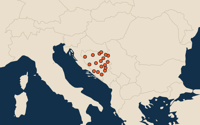
On the map
More in Bosnia and Herzegovina
- 25 largest cities in Bosnia and Herzegovina
- 10 most populous cantons, regions and the district of Bosnia and Herzegovina
- 10 longest rivers in Bosnia and Herzegovina
- 25 highest peaks in Bosnia and Herzegovina
- 10 largest cities in Bosnia and Herzegovina
- Cities ranked 26–50 in Bosnia and Herzegovina
Similar quizzes
- States and the federal district of the United States
- 10 most populous states and the federal district of the United States
- States and union territories of India
- 10 most populous states and union territories of India
- States and the federal district of Brazil
- 10 most populous states and the federal district of Brazil
- Provinces, autonomous regions and municipalities of China
- 10 most populous provinces, autonomous regions and municipalities of China
- States of Germany
- 10 most populous states of Germany
- US states