GeotchaA geography quiz on a real globe
3 largest islands on each continent
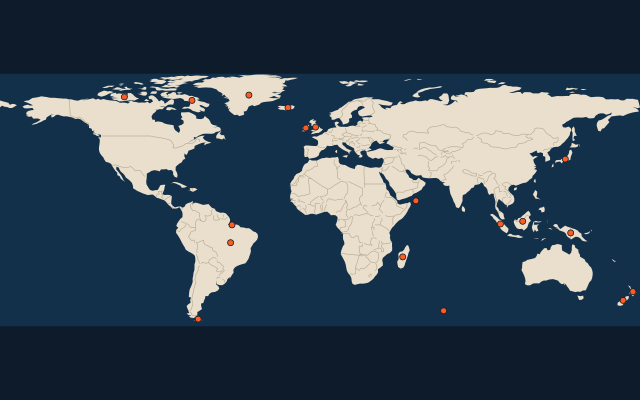
18 islands, each one drawn on a satellite globe. Name it when it lights up, find it when you are given its name, or type every one you can remember in Name all.
Free to play, with no account needed. What you miss comes back for review until it sticks.
The islands
- 1Greenland2,166,086 km²
- 2New Guinea785,753 km²
- 3Borneo748,168 km²
- 4Madagascar587,713 km²
- 5Baffin Island507,451 km²
- 6Sumatra473,481 km²
- 7Honshu227,940 km²
- 8Victoria Island217,291 km²
- 9Great Britain209,331 km²
- 10South Island150,437 km²
- 11North Island113,729 km²
- 12Iceland102,775 km²
- 13Ireland84,421 km²
- 14Isla Grande de Tierra del Fuego47,992 km²
- 15Marajó40,100 km²
- 16Bananal Island19,162 km²
- 17Kerguelen6,675 km²
- 18Socotra3,796 km²
Land area in km²: the Largest Islands set’s figure for its islands, else Wikidata’s (P2046) where it fits the outline, else the area of the outline. Every island Natural Earth draws at 1:10m that Wikidata names, of 5 km² or more (smaller ones when well known), and every island of the Largest Islands set. Countries are those the island’s land lies in, from the outlines. Islands in Antarctica are left out unless the quiz includes Antarctica. One per group: the 3 largest islands of each continent by this measure, then ranked together.
On the map
More of the world
- Largest city of each 10° band of latitude
- Largest country on each continent
- Most populous region of each country, top 100
- Highest peak of each country
- Largest lake on each continent
- Longest river on each continent
- Largest island on each continent
- Largest city of each 30° band of longitude
- Most populous country on each continent
- Highest peak on each continent