GeotchaA geography quiz on a real globe
25 largest islands in Sweden
25 islands, each one drawn on a satellite globe. Name it when it lights up, find it when you are given its name, or type every one you can remember in Name all.
Free to start: a few quizzes a day cost nothing, and Geotcha Plus opens every quiz. What you miss comes back for review until it sticks.
The full list
About this quiz
Gotland is the largest of the 25 islands in this quiz, at 2,968 km²; Frösön is the smallest listed, at 41 km². Gotland's area is 2.2 times Öland's (1,347 km²). The three largest hold 72% of the combined area of all 25.
The islands
- 1Gotland2,968 km²
- 2Öland1,347 km²
- 3Södertörn1,207 km²
- 4Orust346 km²
- 5Hisingen192 km²
- 6Värmdö181 km²
- 7Tjörn147 km²
- 8Väddö128 km²
- 9Fårö114 km²
- 10Selaön95 km²
- 11Gräsö93 km²
- 12Färingsö82 km²
- 13Hertsön73 km²
- 14Alnön65 km²
- 15Ingarö63 km²
- 16Ljusterö62 km²
- 17Torsö62 km²
- 18Ammerön60 km²
- 19Kållandsö57 km²
- 20Mörkö56 km²
- 21Hemsön54 km²
- 22Torö53 km²
- 23Ornö49 km²
- 24Bolmsö42 km²
- 25Frösön41 km²
On the map
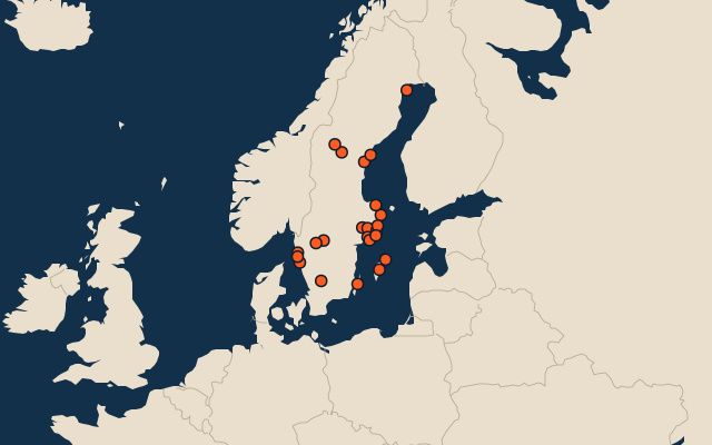
All of Europe
More in Sweden
- 25 largest cities in Sweden
- Counties of Sweden
- 25 largest lakes in Sweden
- 25 longest rivers in Sweden
- 25 highest peaks in Sweden
- 15 best known World Heritage Sites in Sweden
- Flags of the counties of Sweden
- 10 largest cities in Sweden
- 10 most populous counties of Sweden
- Cities ranked 26–50 in Sweden
In the regions of Sweden
- 6 largest islands in Blekinge
- 6 largest islands in Kalmar
- 25 largest islands in Norrbotten
- 6 largest islands in Västerbotten
- 6 largest islands in Västernorrland
- 25 largest islands in Stockholm, Sweden
- 12 largest islands in Västra Götaland
Other countries of Europe
- 18 largest islands in the Faroe Islands
- 8 largest islands in Malta
- 25 largest islands in Germany
- 25 largest islands in Italy
- 25 largest islands in Russia
- 25 largest islands in France
- 25 largest islands in the United Kingdom
- 25 largest islands in Spain
The whole world
How the figures are measured
Land area in km²: the Largest Islands set’s figure for its islands, else Wikidata’s (P2046) where it fits the outline, else the area of the outline. Every island Natural Earth draws at 1:10m that Wikidata names, of 5 km² or more (smaller ones when well known), and every island of the Largest Islands set. Countries are those the island’s land lies in, from the outlines.