GeotchaA geography quiz on a real globe
10 most populous counties of Sweden
10 counties, each one drawn on a satellite globe. Name it when it lights up, find it when you are given its name, tell its flag from three others, or type every one you can remember in Name all.
Free to start: a few quizzes a day cost nothing, and Geotcha Plus opens every quiz. What you miss comes back for review until it sticks.
The full list
About this quiz
Stockholm is the largest of the 10 counties in this quiz, at 2.5 M; Dalarna is the smallest listed, at 286 k. The three largest hold 70% of the combined population of all 10.
What they are known for
- Stockholm: Capital on 14 islands with Gamla Stan, the Vasa warship and Nobel Prize ceremonies.
- Västra Götaland: West coast with Gothenburg, Volvo, the Bohuslän granite archipelago and Lake Vänern.
- Skåne: Southernmost, flat and fertile, linked to Copenhagen by the Öresund Bridge; Malmö, Lund and Ystad.
- Östergötland: Göta Canal lake lands, with Linköping's cathedral and Saab aircraft, Vadstena abbey and Norrköping's old mills.
- Uppsala: Sweden's oldest university and the royal burial mounds of the pagan kings, with a great Gothic cathedral.
- Jönköping: South Swedish Highlands on the shore of Lake Vättern, with the match industry and Gränna's candy canes.
- Halland: Sunny west coast with beaches, Varberg fortress and Falkenberg's salmon river.
- Örebro: Central lands with a medieval fairytale castle in the city centre, Hjälmaren lake and mining history.
The counties
- 1Stockholm2.5 M
- 2Västra Götaland1.8 M
- 3Skåne1.4 M
- 4Östergötland472 k
- 5Uppsala410 k
- 6Jönköping370 k
- 7Halland347 k
- 8Örebro308 k
- 9Södermanland300 k
- 10Dalarna286 k
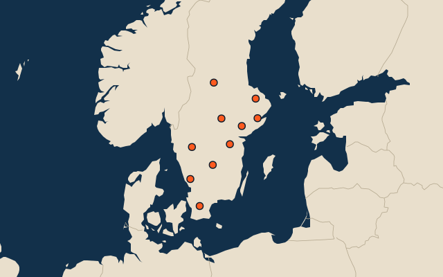
On the map
All of Europe
More in Sweden
- 25 largest cities in Sweden
- Counties of Sweden
- 25 largest lakes in Sweden
- 25 longest rivers in Sweden
- 25 highest peaks in Sweden
- 25 largest islands in Sweden
- 15 best known World Heritage Sites in Sweden
- Flags of the counties of Sweden
- 10 largest cities in Sweden
- Municipalities of Sweden
Other countries of Europe
- States of Germany
- 10 most populous states of Germany
- Districts of Germany
- 25 most populous districts of Germany
- Regions of Italy
- 10 most populous regions of Italy
- Provinces of Italy
- 25 most populous provinces of Italy
How the figures are measured
First-level units: the 21 counties; the 290 municipalities are the second level. Population of each region: the latest figure recorded on Wikidata (P1082), checked against the outline, so a figure belonging to another unit (the capital city, a larger or reorganised region) or implausible for the region is not used. Each item names its source and year. Regions without a figure are left out.