GeotchaA geography quiz on a real globe
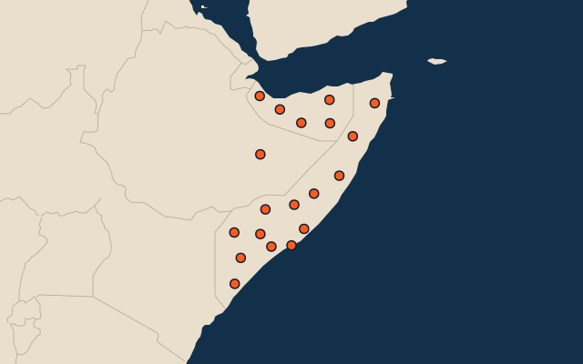
19 largest regions with Somali as an official language
19 regions, each one drawn on a satellite globe. Name it when it lights up, find it when you are given its name, or type every one you can remember in Name all.
Free to start: a few quizzes a day cost nothing, and Geotcha Plus opens every quiz. What you miss comes back for review until it sticks.
The full list
About this quiz
Somali is the largest of the 19 regions in this quiz, at 311,494 km²; Banaadir is the smallest listed, at 130 km². Somali's area is 4.5 times Bari's (68,520 km²). The three largest hold 46% of the combined area of all 19. Somalia has 18 of the 19, in a list that spans two countries.
What they are known for
- Somali: Vast eastern lowlands of camel and goat herders, the Ogaden, with Shebelle and Jubba river basins.
- Bari: Bosaso’s Gulf of Aden port and the tip of Cape Guardafui mark the mountainous northeastern coast.
- Mudug: Galkayo’s trading crossroads and the fishing ports of Hobyo and Harardhere span dry plains and ocean shore.
- Sanaag: Erigavo’s mountain plateau, the Daallo forests and frankincense country rise above the Gulf of Aden.
- Galguduud: Dhusamareb and Adado anchor dry pastoral country, with camel herds and a long Indian Ocean shore.
- Lower Juba: Kismayo’s port, river-mouth farms and mangrove-fringed islands lie along the Kenyan border.
- Gedo: Bardera’s riverside farms and the border town of Doolow lie near Ethiopia and Kenya.
- Bay: Baidoa’s markets anchor sorghum-growing inland plains with Digil and Mirifle farming communities.
The regions
- 1Somali Ethiopia311,494 km²
- 2Bari Somalia68,520 km²
- 3Mudug Somalia59,184 km²
- 4Sanaag Somalia54,080 km²
- 5Galguduud Somalia50,899 km²
- 6Lower Juba Somalia48,153 km²
- 7Gedo Somalia45,489 km²
- 8Bay Somalia44,130 km²
- 9Sool Somalia38,468 km²
- 10Hiran Somalia34,718 km²
- 11Togdheer Somalia31,361 km²
- 12Woqooyi Galbeed Somalia29,357 km²
- 13Nugal Somalia26,708 km²
- 14Bakool Somalia25,838 km²
- 15Lower Shabelle Somalia25,681 km²
- 16Middle Juba Somalia18,904 km²
- 17Middle Shabelle Somalia18,768 km²
- 18Awdal Somalia17,921 km²
- 19Banaadir Somalia130 km²
On the map
More in Somali
Similar quizzes
- 25 largest regions with English as an official language
- 25 largest regions with French as an official language
- 25 largest regions with Spanish as an official language
- 25 largest regions with Hindi as an official language
- 25 largest regions with Chinese as an official language
- 25 largest regions with Arabic as an official language
- 13 largest regions with Urdu as an official language
- 25 largest regions with Portuguese as an official language
How the figures are measured
Area in km²: else the area measured on the outline. Each item names its source. Official languages: official nationally, as the Unicode CLDR territory data and the CIA World Factbook record them; a city or region counts with its own official languages, else those of the region or country it lies in.