GeotchaA geography quiz on a real globe
17 largest regions with Tamil as an official language
17 regions, each one drawn on a satellite globe. Name it when it lights up, find it when you are given its name, or type every one you can remember in Name all.
Free to start: a few quizzes a day cost nothing, and Geotcha Plus opens every quiz. What you miss comes back for review until it sticks.
The full list
About this quiz
Tamil Nadu is the largest of the 17 regions in this quiz, at 130,058 km²; North East Community Development Council is the smallest listed, at 28 km². Tamil Nadu's area is more than ten times North Central Province's (10,687 km²). The three largest hold 73% of the combined area of all 17. Sri Lanka has nine of the 17, in a list that spans three countries.
What they are known for
- Tamil Nadu: Southern state of Dravidian temple towers at Madurai, Chennai's Marina beach, Tamil language and Kanchipuram silk.
- North Central Province: Ancient royal heartland with Anuradhapura stupas, Polonnaruwa ruins and vast irrigation tanks.
- Eastern Province: Province with Trincomalee’s natural harbour, Batticaloa lagoon and the surfing beaches of Arugam Bay.
- Northern Province: Province with Jaffna’s Hindu temples, the Palmyra-covered peninsula and islands in the Palk Strait.
- Uva Province: Hill-country province with Ella’s Nine Arch Bridge, Badulla and the tea slopes around Haputale.
- North Western Province: Province with Kurunegala’s rocky hills, Puttalam lagoon and the fishing villages around Kalpitiya.
- Andaman and Nicobar Islands: Archipelago in the Bay of Bengal closer to Myanmar, with coral reefs, white beaches and a colonial prison in Port Blair.
- Central Province: Hill-country province with Kandy’s Temple of the Tooth, Nuwara Eliya tea estates and Sigiriya rock fortress.
The regions
- 1Tamil Nadu India130,058 km²
- 2North Central Province Sri Lanka10,687 km²
- 3Eastern Province Sri Lanka9,898 km²
- 4Northern Province Sri Lanka9,525 km²
- 5Uva Province Sri Lanka8,628 km²
- 6North Western Province Sri Lanka8,510 km²
- 7Andaman and Nicobar Islands India8,249 km²
- 8Central Province Sri Lanka5,730 km²
- 9Southern Province Sri Lanka5,561 km²
- 10Sabaragamuwa Province Sri Lanka4,943 km²
- 11Western Province Sri Lanka3,758 km²
- 12Puducherry India492 km²
- 13South West Community Development Council Singapore201 km²
- 14Central Singapore Community Development Council Singapore109 km²
- 15North West Singapore96 km²
- 16South East Community Development Council Singapore79 km²
- 17North East Community Development Council Singapore28 km²
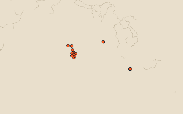
On the map
More in Tamil
Similar quizzes
- 25 largest regions with English as an official language
- 25 largest regions with French as an official language
- 25 largest regions with Spanish as an official language
- 25 largest regions with Hindi as an official language
- 25 largest regions with Chinese as an official language
- 25 largest regions with Arabic as an official language
- 13 largest regions with Urdu as an official language
- 25 largest regions with Portuguese as an official language
How the figures are measured
Area in km²: Wikidata’s figure (P2046, the whole or the land area, whichever matches the outline) where it is within a factor of two of the outline’s area; the official area where the national statistics office gives one (countries whose divisions changed since Natural Earth); else the area measured on the outline. Each item names its source. Official languages: official nationally, as the Unicode CLDR territory data and the CIA World Factbook record them; a city or region counts with its own official languages, else those of the region or country it lies in.