GeotchaA geography quiz on a real globe
10 most populous regions of Morocco
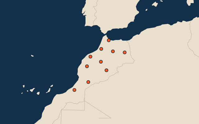
10 regions, each one drawn on a satellite globe. Name it when it lights up, find it when you are given its name, or type every one you can remember in Name all.
Free to start: a few quizzes a day cost nothing, and Geotcha Plus opens every quiz. What you miss comes back for review until it sticks.
The full list
About this quiz
Casablanca-Settat is the largest of the 10 regions in this quiz, at 8.2 M; Guelmim-Oued Noun is the smallest listed, at 477 k. The three largest hold 49% of the combined population of all 10.
What they are known for
- Casablanca-Settat: Economic powerhouse with the vast Hassan II Mosque over the ocean, a huge port and El Jadida's Portuguese cistern.
- Rabat-Salé-Kénitra: The national capital with Hassan Tower and the Kasbah of the Udayas, on the Atlantic with cork forests.
- Marrakesh-Safi: Red-walled imperial city with Jemaa el-Fnaa square, a pottery port and windy, blue-boat Essaouira.
- Fez-Meknes: Medieval medina maze with leather tanneries, the Roman ruins of Volubilis and an imperial city with Bab Mansour.
- Tangier-Tétouan-Al Hoceima: Strait gateway to Spain, with blue-washed Chefchaouen in the Rif mountains and Mediterranean beaches.
- Souss-Massa: Agadir's resort beaches, argan groves, Tafraoute's pink-painted rocks and rare bald ibis.
- Béni Mellal-Khénifra: Middle and High Atlas, with Ouzoud Falls, Bin el Ouidane lake and orange farms.
- Oriental: Algerian border country with Saidia beach, Berkane clementines, Nador lagoon and Figuig oasis.
The regions
- 1Casablanca-Settat8.2 M
- 2Rabat-Salé-Kénitra5.5 M
- 3Marrakesh-Safi5.2 M
- 4Fez-Meknes4.7 M
- 5Tangier-Tétouan-Al Hoceima4.3 M
- 6Souss-Massa3.2 M
- 7Béni Mellal-Khénifra2.7 M
- 8Oriental2.4 M
- 9Drâa-Tafilalet1.8 M
- 10Guelmim-Oued Noun477 k
On the map
All of Africa
More in Morocco
- 25 largest cities in Morocco
- Regions of Morocco
- 11 longest rivers in Morocco
- 17 highest peaks in Morocco
- 9 best known World Heritage Sites in Morocco
- 10 largest cities in Morocco
- Cities ranked 26–50 in Morocco
- Regional capitals of Morocco
- Cities over 100,000 in Morocco
Other countries of Africa
- States and the capital territory of Nigeria
- 10 most populous states and the capital territory of Nigeria
- Districts of Côte d'Ivoire
- 10 most populous districts of Côte d'Ivoire
- Provinces of South Africa
- 9 most populous provinces of South Africa
- Provinces of Algeria
- 10 most populous provinces of Algeria
How the figures are measured
Population of each region: a 2025 estimate: the latest official figure (a census or an estimate, as each item names it) scaled with the rest of its country’s regions to the World Bank’s 2025 national total, so a country’s regions share one year. Each item names its source and year. Regions without a figure are left out.