GeotchaA geography quiz on a real globe
10 most populous regions of Chile
10 regions, each one drawn on a satellite globe. Name it when it lights up, find it when you are given its name, tell its flag from three others, or type every one you can remember in Name all.
Free to start: a few quizzes a day cost nothing, and Geotcha Plus opens every quiz. What you miss comes back for review until it sticks.
The full list
About this quiz
Santiago is the largest of the 10 regions in this quiz, at 8 M; Ñuble is the smallest listed, at 551 k. Santiago's population is 3.9 times Valparaíso's (2 M). The three largest hold 65% of the combined population of all 10.
What they are known for
- Santiago: Capital region in a valley beneath the Andes, with La Moneda palace, Cerro San Cristóbal and the nation's biggest city.
- Valparaíso: Colourful hillside port with funiculars, Neruda's house and Viña del Mar's beaches; also home of Chile's Congress.
- Biobío: Industrial southern region around Concepción, with coal, Lota's mines, steel and the Pacific port of Talcahuano.
- Maule: Central valley wine region of Talca, hot summers, Cauquenes and Carmenère and Chilean cueca folk dance.
- Araucanía: Mapuche homeland of araucaria trees, Villarrica and Llaima volcanoes, and lakes around Pucón.
- O'Higgins: Central valley of Colchagua wines, Rancagua's rodeo and El Teniente, the world's largest underground copper mine.
- Los Lagos: Lake district with Osorno volcano, Chiloé's wooden churches and palafito houses, and German heritage at Puerto Varas.
- Coquimbo: Pisco country with clear skies for observatories, the Elqui Valley, La Serena's old centre and poet Gabriela Mistral's Vicuña.
The regions
- 1Santiago8 M
- 2Valparaíso2 M
- 3Biobío1.7 M
- 4Maule1.2 M
- 5Araucanía1.1 M
- 6O'Higgins1.1 M
- 7Los Lagos957 k
- 8Coquimbo895 k
- 9Antofagasta683 k
- 10Ñuble551 k
On the map
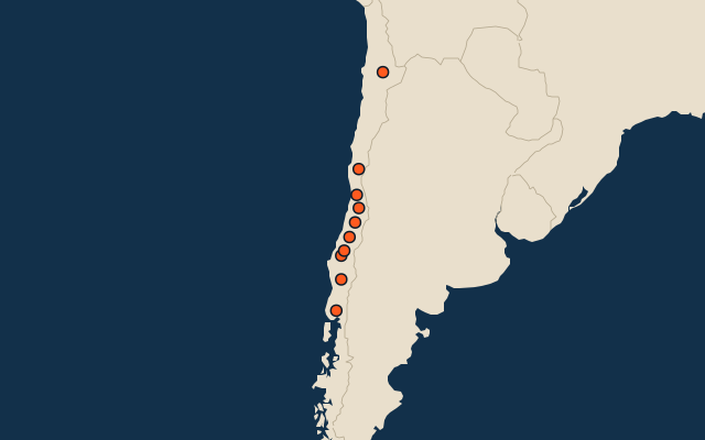
All of South America
More in Chile
- 25 largest cities in Chile
- Regions of Chile
- 7 largest lakes in Chile
- 25 longest rivers in Chile
- 25 highest peaks in Chile
- 25 largest islands in Chile
- 6 best known World Heritage Sites in Chile
- Flags of the regions of Chile
- 10 largest cities in Chile
- Provinces of Chile
Other countries of South America
- States and the federal district of Brazil
- 10 most populous states and the federal district of Brazil
- Departments and the capital district of Colombia
- 10 most populous departments and the capital district of Colombia
- Provinces of Argentina
- 10 most populous provinces of Argentina
- Departments of Argentina
- 25 most populous departments of Argentina
How the figures are measured
First-level units: the 16 regions; the 56 provinces are the second level. Population of each region: a 2025 estimate: the latest official figure (a census or an estimate, as each item names it) scaled with the rest of its country’s regions to the World Bank’s 2025 national total, so a country’s regions share one year. Each item names its source and year. Regions without a figure are left out.