GeotchaA geography quiz on a real globe
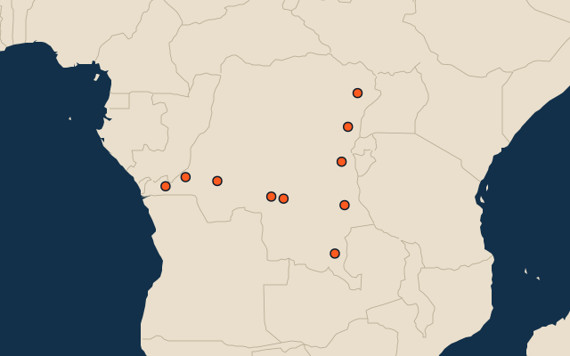
10 most populous provinces and the city of the Democratic Republic of the Congo
10 provinces and the city, each one drawn on a satellite globe. Name it when it lights up, find it when you are given its name, or type every one you can remember in Name all.
Free to start: a few quizzes a day cost nothing, and Geotcha Plus opens every quiz. What you miss comes back for review until it sticks.
The full list
About this quiz
Kinshasa is the largest of the 10 provinces and the city in this quiz, at 16 M; Tanganyika is the smallest listed, at 4.1 M. Kinshasa's population is 1.8 times North Kivu's (8.7 M). The three largest hold 46% of the combined population of all 10.
What they are known for
- Kinshasa: The national capital spreads along the Congo River opposite Brazzaville, with rumba music and busy markets.
- North Kivu: Goma’s lakeside lava fields, Nyiragongo volcano and Virunga’s mountain gorillas lie here.
- South Kivu: Bukavu’s lakeside hills and Kahuzi-Biega’s gorilla forests rise above the Ruzizi valley.
- Kongo Central: Matadi’s river port, Boma’s colonial buildings and the Atlantic coast at Muanda lie here.
- Kwilu: Kikwit’s markets and Bandundu’s river port serve farming country west of the central forest.
- Haut-Katanga: Lubumbashi and Likasi anchor a copper-mining belt with industrial towns near the Zambian frontier.
- Ituri: Bunia anchors northeastern highlands; Epulu’s forest shelters okapis, while Lake Albert marks the eastern edge.
- Kasaï-Central: Kananga’s markets and railway station lie amid Lulua river country and savanna villages.
The provinces and the city
- 1Kinshasa16 M
- 2North Kivu8.7 M
- 3South Kivu7.5 M
- 4Kongo Central7.3 M
- 5Kwilu7.1 M
- 6Haut-Katanga6.2 M
- 7Ituri4.6 M
- 8Kasaï-Central4.3 M
- 9Kasaï-Oriental4.1 M
- 10Tanganyika4.1 M
On the map
All of Africa
More in Democratic Republic of the Congo
- 25 largest cities in the Democratic Republic of the Congo
- Provinces and the city of the Democratic Republic of the Congo
- 8 largest lakes in the Democratic Republic of the Congo
- 22 longest rivers in the Democratic Republic of the Congo
- 11 highest peaks in the Democratic Republic of the Congo
- 10 largest cities in the Democratic Republic of the Congo
- Cities ranked 26–50 in the Democratic Republic of the Congo
- Provincial capitals of the Democratic Republic of the Congo
- Cities over 100,000 in the Democratic Republic of the Congo
Other countries of Africa
- States and the capital territory of Nigeria
- 10 most populous states and the capital territory of Nigeria
- Districts of Côte d'Ivoire
- 10 most populous districts of Côte d'Ivoire
- Provinces of South Africa
- 9 most populous provinces of South Africa
- Provinces of Algeria
- 10 most populous provinces of Algeria
How the figures are measured
Population of each region: a 2025 estimate: the latest official figure (a census or an estimate, as each item names it) scaled with the rest of its country’s regions to the World Bank’s 2025 national total, so a country’s regions share one year. Each item names its source and year. Regions without a figure are left out.