GeotchaA geography quiz on a real globe
Provincial capitals of Canada
13 provincial capitals, each one drawn on a satellite globe. Name it when it lights up, find it when you are given its name, or type every one you can remember in Name all.
Free to start: a few quizzes a day cost nothing, and Geotcha Plus opens every quiz. What you miss comes back for review until it sticks.
The full list
About this quiz
Toronto is the largest of the 13 provincial capitals in this quiz, at 3.3 M; Iqaluit is the smallest listed, at 7 k. Toronto's population is 3.2 times Edmonton's (1 M). The three largest hold 76% of the combined population of all 13.
The provincial capitals
- 1Toronto3.3 M
- 2Edmonton1 M
- 3Winnipeg750 k
- 4Quebec City574 k
- 5Halifax440 k
- 6Regina226 k
- 7St. John's111 k
- 8Victoria92 k
- 9Fredericton63 k
- 10Charlottetown39 k
- 11Whitehorse28 k
- 12Yellowknife20 k
- 13Iqaluit7 k
On the map
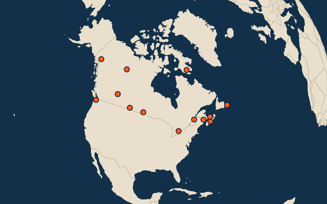
All of North America
More in Canada
- 25 largest cities in Canada
- Provinces and territories of Canada
- 25 largest lakes in Canada
- 25 longest rivers in Canada
- 25 highest peaks in Canada
- 25 largest islands in Canada
- 25 longest fjords in Canada
- Flags of the provinces and territories of Canada
- 10 largest cities in Canada
- 10 most populous provinces and territories of Canada
In the regions of Canada
- 10 largest cities in Alberta
- 10 largest cities in British Columbia
- 10 largest cities in Manitoba
- 10 largest cities in New Brunswick
- 10 largest cities in Newfoundland and Labrador
- 10 largest cities in Nova Scotia
- 10 largest cities in Ontario
- 10 largest cities in Quebec
Other countries of North America
- 25 largest cities in the United States
- 10 largest cities in the United States
- Cities ranked 26–50 in the United States
- State capitals of the United States
- 25 largest cities in Mexico
- 10 largest cities in Mexico
- Cities ranked 26–50 in Mexico
- State capitals of Mexico
The whole world
How the figures are measured
Capitals of first-level administrative units (states, provinces, regions): the capital Wikidata records for the unit (P36), else the seat GeoNames records for it (PPLA); a second, summer or winter capital is left out. A national capital is in only where it is also its unit’s seat (Canberra for the Australian Capital Territory, Brasília for the Federal District), not where the unit has another capital (Ottawa: Toronto; Amsterdam: Haarlem).