GeotchaA geography quiz on a real globe
Provinces of Peru
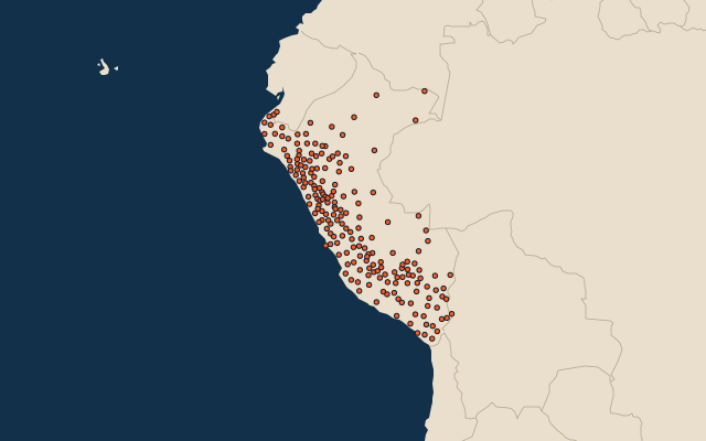
196 provinces, each one drawn on a satellite globe. Name it when it lights up, find it when you are given its name, or type every one you can remember in Name all.
Free to play, with no account needed. What you miss comes back for review until it sticks.
The provinces
- 1Maynas75,069 km²
- 2Loreto67,073 km²
- 3Requena49,680 km²
- 4Datem del Marañón46,641 km²
- 5Putumayo45,139 km²
- 6Atalaya38,914 km²
- 7Mariscal Ramón Castilla37,065 km²
- 8Coronel Portillo36,845 km²
- 9Tambopata36,268 km²
- 10La Convención30,062 km²
- 11Ucayali29,267 km²
- 12Manu27,835 km²
- 13Tahuamanu21,197 km²
- 14Satipo19,219 km²
- 15Alto Amazonas18,839 km²
- 16Condorcanqui17,975 km²
- 17Purús17,848 km²
- 18Oxapampa17,767 km²
- 19Mariscal Cáceres14,499 km²
- 20Lucanas14,495 km²
- 21Caylloma14,019 km²
- 22Caravelí13,140 km²
- 23Carabaya12,266 km²
- 24Sandia11,862 km²
- 25Puno11,497 km²
- 26Puerto Inca10,341 km²
- 27Arequipa9,682 km²
- 28Lambayeque9,613 km²
- 29Mariscal Nieto8,672 km²
- 30Padre Abad8,592 km²
- 31Tacna8,066 km²
- 32Bellavista8,033 km²
- 33Ica7,894 km²
- 34Quispicanchi7,565 km²
- 35Condesuyos6,958 km²
- 36Castilla6,914 km²
- 37Yauyos6,899 km²
- 38Huaytará6,458 km²
- 39Melgar6,447 km²
- 40Sechura6,312 km²
- 41Paucartambo6,295 km²
- 42Piura6,077 km²
- 43Parinacochas5,968 km²
- 44Tocache5,865 km²
- 45Lampa5,792 km²
- 46General Sánchez Cerro5,682 km²
- 47Huarochirí5,658 km²
- 48Bagua5,653 km²
- 49San Martín5,650 km²
- 50El Collao5,601 km²
- 51Sullana5,459 km²
- 52Pasco5,374 km²
- 53Chumbivilcas5,371 km²
- 54Espinar5,311 km²
- 55Nasca5,234 km²
- 56Jaén5,233 km²
- 57Ayabaca5,221 km²
- 58Lamas5,083 km²
- 59San Ignacio4,977 km²
- 60Azángaro4,970 km²
and 136 more, all in the quiz.
Second-level units: the 196 provinces, within the 26 regions (the first level), which the region hint names. Area in km²: Wikidata’s figure (P2046, the whole or the land area, whichever matches the outline) where it is within a factor of two of the outline’s area; the official area where the national statistics office gives one (countries whose divisions changed since Natural Earth). Each item names its source. Sources: OpenStreetMap (ODbL), Wikidata (CC0), national statistics offices.
On the map
More in Peru
- 25 largest cities in Peru
- Regions of Peru
- 25 longest rivers in Peru
- 25 highest peaks in Peru
- 6 largest islands in Peru
- Flags of the regions of Peru
- 10 largest cities in Peru
- 10 most populous regions of Peru
- Cities ranked 26–50 in Peru
- 25 most populous provinces of Peru
Similar quizzes
- States of the United States
- 10 most populous states of the United States
- Counties of the United States
- 25 most populous counties of the United States
- States of India
- 10 most populous states of India
- Districts of India
- 25 most populous districts of India
- States and the federal district of Brazil
- 10 most populous states and the federal district of Brazil
- US states