GeotchaA geography quiz on a real globe
Provinces of Iran
31 provinces, each one drawn on a satellite globe. Name it when it lights up, find it when you are given its name, or type every one you can remember in Name all.
Free to start: a few quizzes a day cost nothing, and Geotcha Plus opens every quiz. What you miss comes back for review until it sticks.
The full list
About this quiz
Sistan and Baluchestan is the largest of the 31 provinces in this quiz, at 181,785 km²; Alborz is the smallest listed, at 5,833 km². The three largest hold 30% of the combined area of all 31.
What they are known for
- Sistan and Baluchestan: Remote southeast province on the Pakistan and Afghan border, with Makran coast, Chabahar port and the Hamun wetlands.
- Kerman: Largest southeastern province, with the Lut desert's yardang, Bam's mud-brick citadel, carpets and pistachios.
- South Khorasan: Eastern desert province on the Afghan border, with saffron, barberry, Lut desert fringes and Tabas.
- Yazd: Desert city of mud-brick wind catchers, qanats, Zoroastrian fire temples and a historic Jameh mosque and sweets.
- Fars: Cradle of ancient Persia, with Persepolis, Pasargadae and Cyrus the Great's tomb, plus poets' tombs and rose water.
- Razavi Khorasan: Northeastern province holding Iran's holiest Shia shrine of Imam Reza, the poet Ferdowsi's tomb and saffron fields.
- Isfahan: Heart of Persia, with Naqsh-e Jahan Square, Safavid mosques, the Si-o-se-pol bridge and its blue tiles and sweets.
- Semnan: Desert and mountain province with Damghan's Tepe Hissar mound, Dasht-e Kavir salt flats and a rocket launch site.
The provinces
- 1Sistan and Baluchestan181,785 km²
- 2Kerman180,726 km²
- 3South Khorasan151,193 km²
- 4Yazd129,285 km²
- 5Fars122,608 km²
- 6Razavi Khorasan118,884 km²
- 7Isfahan107,029 km²
- 8Semnan97,491 km²
- 9Hormozgan70,697 km²
- 10Khuzestan64,055 km²
- 11East Azerbaijan45,650 km²
- 12West Azerbaijan37,437 km²
- 13Kurdistan29,137 km²
- 14Markazi29,127 km²
- 15North Khorasan28,434 km²
- 16Lorestan28,294 km²
- 17Kermanshah25,009 km²
- 18Mazandaran23,842 km²
- 19Bushehr22,743 km²
- 20Zanjan21,773 km²
- 21Golestan20,367 km²
- 22Ilam20,133 km²
- 23Hamadan19,368 km²
- 24Tehran18,814 km²
- 25Ardabil17,800 km²
- 26Chaharmahal and Bakhtiari16,332 km²
- 27Qazvin15,567 km²
- 28Kohgiluyeh and Boyer-Ahmad15,504 km²
- 29Gilan14,042 km²
- 30Qom11,526 km²
- 31Alborz5,833 km²
On the map
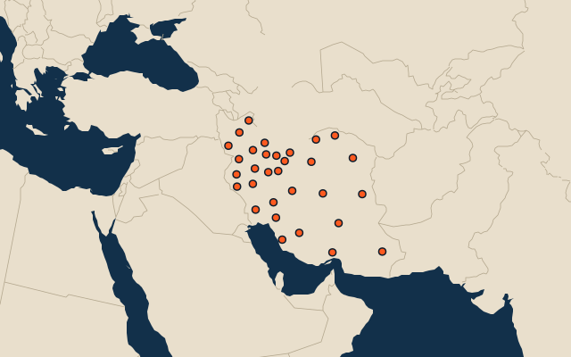
All of Asia
More in Iran
- 25 largest cities in Iran
- 10 most populous provinces of Iran
- 25 longest rivers in Iran
- 25 highest peaks in Iran
- 14 largest islands in Iran
- 25 best known World Heritage Sites in Iran
- 10 largest cities in Iran
- Cities ranked 26–50 in Iran
- Provincial capitals of Iran
- Cities over 100,000 in Iran
Other countries of Asia
- States of India
- 10 most populous states of India
- Districts of India
- 25 most populous districts of India
- Provinces of China
- 10 most populous provinces of China
- Prefectures of China
- 25 most populous prefectures of China
How the figures are measured
The 31 provinces of Iran.